Lisbon Valley Mine reopens with AI, robots
⛏️ Mining Monitor ⛏️

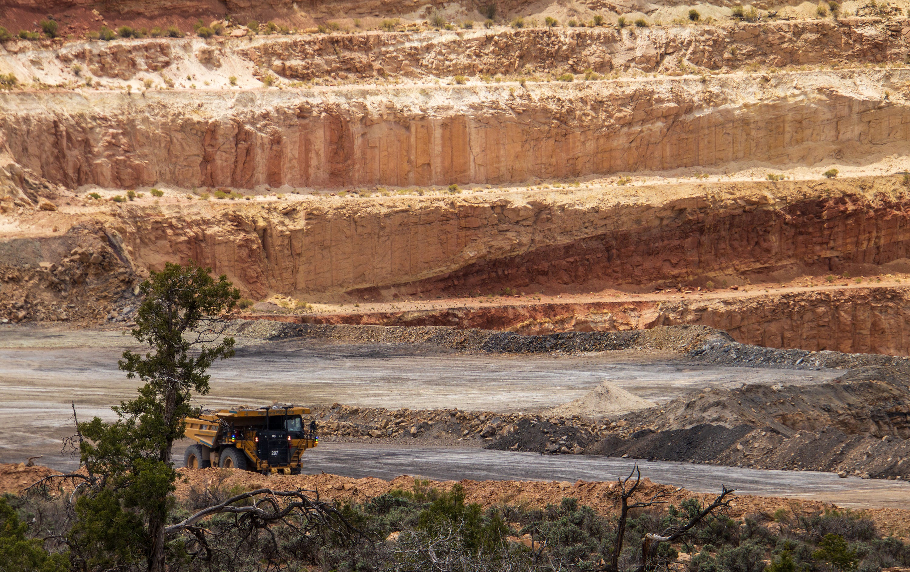
Every six months or so I like to do a recon of the Lisbon Valley in southeastern Utah, a long-time sacrifice zone for uranium and copper mining, oil and gas drilling, natural gas processing, and now lithium extraction — not to mention cattle grazing — to see about the latest developments. My takeaway from my latest visit: The sacrifice continues — both in a real sense and a speculative one.
The speculation is in the form of a rush to stake mining claims on nearly every inch of available public land in the valley. This phenomenon isn’t readily apparent on the ground, but showed up indirectly in the form of orange No Trespassing signs posted on public roads in one specific area. Except they aren’t really prohibiting trespassing — that would be illegal. They are just pointing out that the Lisbon Valley Mining Company has already claimed all of the public land around there, so new would-be claimants should just stay away.
Meanwhile, after shutting down in 2024 due to high costs and staffing challenges, the Lisbon Valley copper mine, which posted the signs, is back in business. Late last year Mariana Minerals, backed by the Silicon Valley venture capital firm Andreessen Horowitz, purchased the then-idled mine. Mariana’s CEO is Turner Caldwell, who previously ran Tesla’s battery minerals unit. Perhaps it was his cybertruck that sat in the mine’s parking lot when I drove by recently.
At the mine’s grand reopening ceremony last month, Caldwell said he was hoping to “fundamentally reinvent how infrastructure is built, how mines are operated and how refineries are operated.” This includes using autonomous drills, equipment, and haul trucks, as well as robots to do inspections and conduct more hazardous work.
This purportedly will allow the operation to increase production from about 2,500 tons annually under the previous ownership, to a target of 50,000 tons per year by 2030 — an enormous jump. Historically, the most the mine produced was about 10,000 tons annually. But last year the BLM approved the company’s proposed expansion of its open pit operations and to add an in-situ extraction operation — a prospect that alarmed nearby residents concerned about contamination of aquifers.
Caldwell is vague about the number of jobs the revived operation will create. On the one hand, he’s said he plans on hiring “hundreds” of new workers and invest over $1 billion. On the other, the autonomous equipment’s main asset is that it alleviates past staffing difficulties. As of early May, the Mariana website advertised just 19 open jobs at the Lisbon Valley site. That includes several salaried positions, with pay ranging from $100,000 to about $180,000 per year, as well as drillers, equipment operators, and mechanics at $25 to $45 per-hour wages. Interns could earn $30/hour.
Whether any of that will be enough to afford housing in Moab or even La Sal or Monticello is unclear.
I passed through there on a Sunday, and things were quiet. One haul truck was sitting in the pit, and it appeared as if it was running but it wasn’t doing any hauling. I couldn’t get close enough to confirm that there was no human driver, but the cab did look empty. There were no robots in sight.
Meanwhile, down in Arizona’s copper country, the Center for Biological Diversity, the San Carlos Apache Tribe, and the Lower San Pedro Watershed Alliance filed an intent to sue the Trump administration over its approval of Faraday’s Copper Creek exploratory drilling project east of Mammoth, Arizona, saying it violates the Endangered Species Act.
The exploratory project, a precursor to actual mining, includes 67 drill pads, along with associated roads and infrastructure, on about 78 square kilometers in the Galiuro Mountains in the Lower San Pedro Watershed. Each drill rig requires tens of thousands of gallons of water in an area where communities are facing water shortages and the riparian ecosystem is stressed by prolonged drought. The groups’ lawsuit focuses on the drilling’s impacts on the imperiled Mexican spotted owl and other wildlife.
“The Lower San Pedro watershed is one of Arizona’s most important wildlife corridors, and this exploration project is pushing industrial disturbance into a landscape that is already under pressure,” said Melissa Crytzer Fry, chair for the Lower San Pedro Watershed Alliance. “When agencies ignore clear evidence and fail to follow the law, local communities are left to defend the river, the habitat and the species that make this place irreplaceable.”
🐟 Colorado River Chronicles 💧
If you’re bummed out about the reduced releases from Glen Canyon Dam — and the associated drop in streamflows in the Grand Canyon — you might try going upstream a ways and boating the Green River or the Colorado River below the confluence of the two. On May 1, the Bureau of Reclamation upped releases from Flaming Gorge Dam to full power plant capacity, or 4,600 cubic feet per second. Then, on May 4, they started allowing an additional 4,000 cfs to flow through the dam’s bypass to implement a larval trigger study plan (and to bolster Lake Powell’s levels).

Today (May 5) the Bureau was releasing about 9,000 cfs from the dam. While the first pulse (the May 1 release) has made it downstream, the second one has yet to reach Ouray, Utah, if the USGS streamflow gage is any indication. But as that 9k cfs makes it downstream, it should make for some good boating — or at least better than you’d expect during such a dry year — not only on the Green, but also in Cataract Canyon. Whether it will bail out Lake Powell is another question altogether.

🗺️ Messing with Maps 🧭
A couple of weeks ago I wrote about the Trump administration’s mapping tool, aimed at making America graze again, showing “potentially available” (i.e. vacant) grazing allotments on public lands. Now the mapping folks at Center for Biological Diversity have taken that map, and overlain it with areas of endangered species’ critical habitat and BLM allotment health status. It can be a little overwhelming to navigate because of all the different layers and colors. But you can turn layers on and off to make it easier to use, and it’s valuable for just understanding the landscape in general.
Below is a screenshot of the map showing the “available” Canyons of the Ancients allotments I wrote about visiting. Check out the interactive version for yourself.


