π΅ Public Lands π²
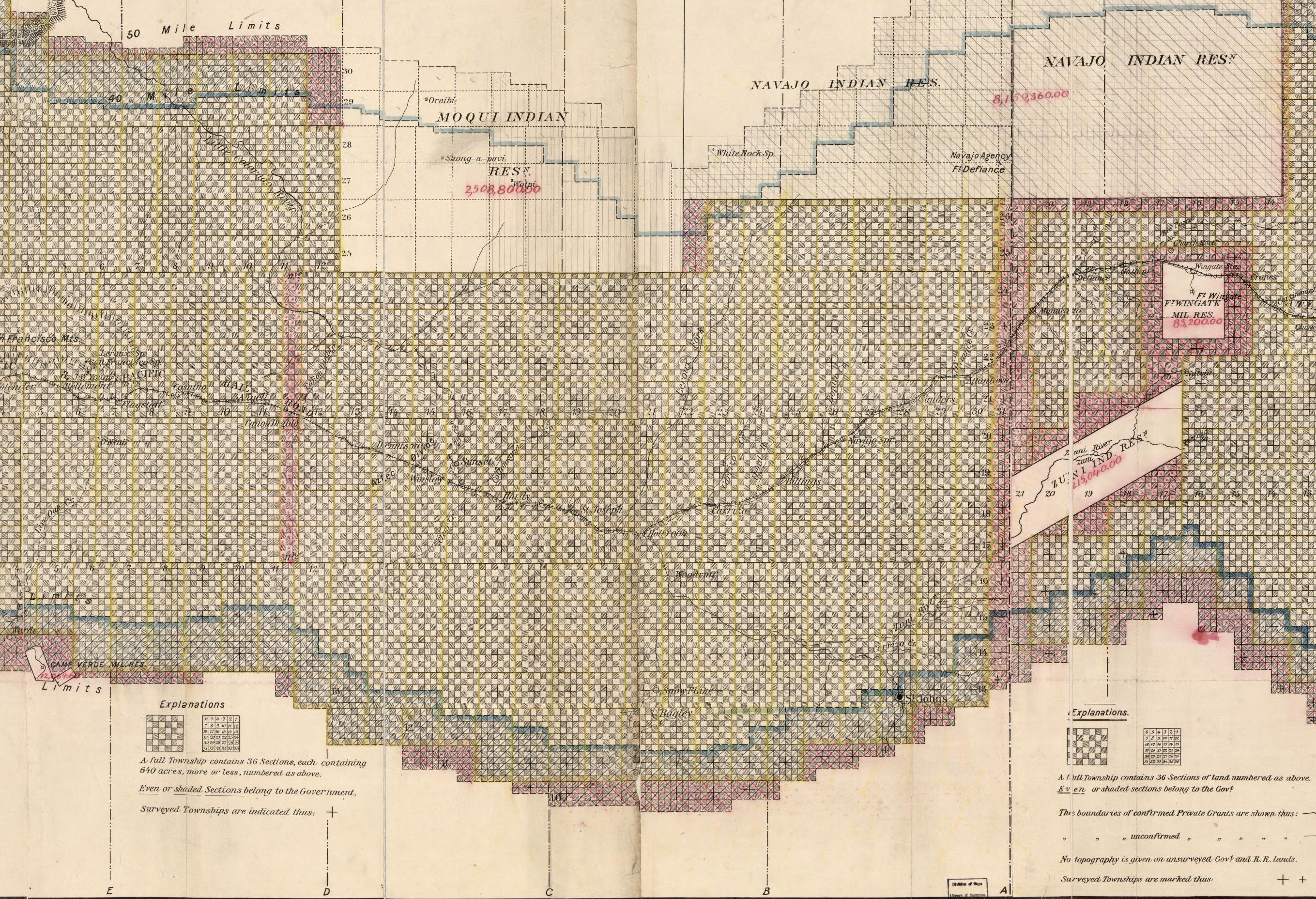
The debate over selling off public land has become more serious, and consequential, than ever. While the urge to transfer public land out of the American publicβs hands has flared up many times over the last century or so, never has the concept gained so much support among establishment politicians and pundits. Neither James Watt, the notoriously anti-conservationist Interior Secretary under Ronald Reagan, nor the fossil fuel-loving officials of the George W. Bush administration, nor even Trump Iβs Interior Secretary, Ryan Zinke, called for wholesale public land transfers.
And yet, now we have not only Interior Secretary Doug Burgum advocating for selling land to states and real estate developers, but also members of Congress and even prominent newspaper columnists and editorial boards doing so. As this extremist threat becomes more real, public land lovers understandably react in extreme ways β including condemning every public land transfer, no matter how small.
I used to bristle at the mention of public land swaps, until the late Paul Beaber, a long-time US Forest Service surveyor, set me straight. He pointed out that not only does the current law allow federal land agencies to βdisposeβ of some parcels, but that in some cases exchanges and even sales can make sense and be beneficial to public land users. (And just to be clear, the current proposals by Republicans in Congress and the Trump administration do not make sense and will not benefit public land users).
The point was raised by Land Desk reader James Aldrich in response to last weekβs piece on the public land sale amendment in Congressβ budget reconciliation bill. He wrote:
I live adjacent to some BLM land in the Mojave Desert. Itβs small by BLM standards, 40 acres, and has been vacant for the 45 years I have been here. It just sits there and is not productive in any way and is of course taking off the property tax rolls. It was also recently completely burned off in the Bobcat fire a few years ago. There are many such properties scattered around the Western States, some as small as 2 Β½ acres. I see no reason why such properties should not be made available to the general public β after all, as citizens of the United States we do own them β they belong to us!
I have to take issue with Jamesβ last sentence here: Saying that public land should be sold because it belongs to all of us is a logical fallacy, since once it is sold it will only belong to one of us! So thatβs not the best justification for selling the land. However, he brings up some other good points.
First, there are hundreds if not thousands of this sort of parcel scattered around the West, these little squares of BLM islands in a sea of private land. The BLM is usually eager to get rid of those parcels, because they not only create a management headache, but also end up serving as something like exclusive parks for the private owner(s) that surround it. They are technically public, but practically private, since the public canβt access them without trespassing on private land.
And, as Luke Schafer put it in a response to Aldrich, the BLM does have a mechanism for βdisposingβ of those parcels.
Regarding the issue of isolated BLM parcels, in nearly every BLM Resource Management Plan revision process, the field office in question identifies lands appropriate for disposal, In some cases, those isolated or inaccessible parcels are combined in larger land swaps with the relevant state land management agencies to facilitate consolidated management.
Iβll get more into how that is typically done in a moment. But first, a bit of history to see how we ended up with these isolated squares of public land.
In 1785, the U.S. Congress of the Confederation passed the Land Ordinance, which in turn created the Public Land Survey System to be applied to the public domain west of the Appalachians (which, at the time, didnβt extend very far). The land was cordoned off into thirty-six-square-mile rectangular townships, which were then sliced into 640-acre sections β a big grid made up of thousands of squares β with zero consideration for topography, watersheds, cultural boundaries, eco-zones, or habitat.
This grid that overlays America is artifice, something seen only on maps, based on nothing real. Yet it has profoundly influenced the way Americans relate to the landscape and to one another, and is manifested physically on the American landscape in its state and county lines, its streets and avenues, its county roads and property lines, and in GPS coordinates. βThe grid, not the eagle or the Stars and Stripes,β wrote John Brinckerhoff Jackson in his seminal A Sense of Place, A Sense of Time, βis our national symbol. It is imprinted in every child before birth.β
As the U.S. government continued to expand its empire westward, usually by stealing land from the Indigenous inhabitants, it added the land to the public domain and imposed the grid onto the landscape to create a system that allowed the government to dispose of β i.e. sell or give away β public land to settlers, would-be farmers, railroads, and miners in an orderly fashion.
The 1862 Homestead Act was created with subsistence farming in mind and allowed a prospective farmer to stake out a 40- to 640-acre claim on the public domain1. But the claimβs boundaries werenβt determined by the topography or richness of the soil, but rather by the PLSS; every homestead was a perfect square that the claimant could work for five years, and then patent it, or take title to the land. The government also gave railways every other square-mile of land in rail corridors to incentivize the rail corporations and to draw more homesteaders, and it allowed mining claimants to patent their claims too.
Every square of the public domain that was not homesteaded, given to the railway, staked with a mining claim and patented, or put into a forest reserve or park remained in the public domain. And land that was homesteaded or otherwise claimed, but not patented, also reverted back to the public domain. The result are numerous, chaotic land-ownership called βcheckerboardsβ due to the square shape of each parcel, or geometrically-correct, jurisdictionally nightmarish hodgepodges of federal, tribal, state, private, and Indian allotment land.
Congress passed the Federal Land Policy Management Act, or FLPMA, in 1976, which ended the mass disposal of public lands. The Homestead Act was repealed, mining claims can still be staked (very easily), but there is a moratorium on new patents, and no one is giving public land to railroads any more β although some folks sure would like to give it to real estate developers. Still, the BLM does leave the door open for some land transfers, mainly to address islands of public land within a sea of private holdings. The BLMβs website describes the process like this:
The law states that the BLM can select lands for sale if, through land-use planning, they are found to meet one of three criteria: 1) they are scattered, isolated tracts that are difficult or uneconomic to manage; 2) they were acquired for a specific purpose and are no longer needed for that purpose; or 3) disposal of the land will serve important public objectives, such as community expansion and economic development.
The agency also works to clean up the checkerboard via land swaps, in which an isolated federal parcel is exchanged for a private one surrounded by public land. While these can be win-win situations, they can also look a bit like blackmail or a hostage situation. In the 1990s and early 2000s, for example, a real estate developer named Tom Chapman made a habit of acquiring private inholdings β often in wilderness areas β and threatening to develop them if the BLM or Forest Service didnβt exchange the inholdings for much more valuable parcels in or near ski resorts and so forth. The agencies usually had little choice but to comply.
But in many cases, the swaps can be beneficial. In the San Juan Mountains, for example, huge mining companies like ASARCO ended up with big blocks of mining claims in the high country, surrounded by public lands. The companies could sell the claims to private individuals, who could then potentially build on them, creating a nightmare for county land-use planners. Or they could turn them over to the feds in exchange for isolated but more developable public parcels elsewhere, allowing the BLM or Forest Service to consolidate its alpine holdings, while also disposing of private-land-locked parcels elsewhere.
Donβt get the wrong idea: The BLM canβt just sell or swap chunks of land at their whim. To sell parcels like those James referred to, the BLM first would have to identify them as βdisposable,β if you will, during the Resource Management Planning process for that particular field office. That is a long process that includes extensive environmental reviews and ample opportunity for public input. Large exchanges, meanwhile, are subject to their own environmental analyses and public comment.
By contrast, the ideologues in Congress now pushing for public land transfers are looking to sell off or give away about a half-million acres. A small portion of the parcels could be considered βscattered, isolated tractsβ that are hard to manage. But others are quite large and, if transferred, would create private inholdings surrounded by public land. This would not only take valuable public land out of the publicβs hands, but also would further complicate management.
So, yes, there are cases in which selling or swapping public land isnβt the end of the world. But the fact is, there are fewer and fewer instances in which that is the case. And selling or swapping public land without public involvement? Thatβs always wrong.
πΈ Parting Shot ποΈ
The Homestead Act allowed for claims of up to 160 acres, which was deemed insufficient for arid lands in the West, so in 1877 the Desert Land Act allowed for claims up to 640 acres, and in 1909 the Enlarged Homestead Act made provisions for 320-acre claims.
Excellent back story.
I think the The Southern Nevada Public Land Management Act (SNPLMA), enacted in 1998, is a good example of a federal law that authorizes the Bureau of Land Management (BLM) to sell or exchange specific parcels of public land within a designated boundary around the Las Vegas Valley. The proceeds from these land sales are allocated to fund various projects aimed at conservation, recreation, and public infrastructure in Nevada. As much as I dislike suburban sprawl, these land exchanges/sales have mostly taken place right on the edge of Las Vegas proper and it seems like a worthwhile trade off.
Also, for more reporting on BLM land sales, see David Willms quotes in this really good piece of reporting: https://www.outdoorlife.com/conservation/federal-land-sale-movement/
I'm headed to Nevada and Utah next week to photograph some of these landscapes that are being proposed for disposal. The biggest chunk of land is in Pershing County (335,000 acres) and it's a checkerboard hellscape. None the less, there is some beautiful scenery, critical habitat, and a rich Indigenous history to preserve. Maybe if people can SEE the landscapes at stake, they'll be more willing to make a raucous.