USDA looks to expand public lands grazing
Plus: Data Center Watch, Mining Monitor, Messing with Maps 1940 edition
🌵 Public Lands 🌲
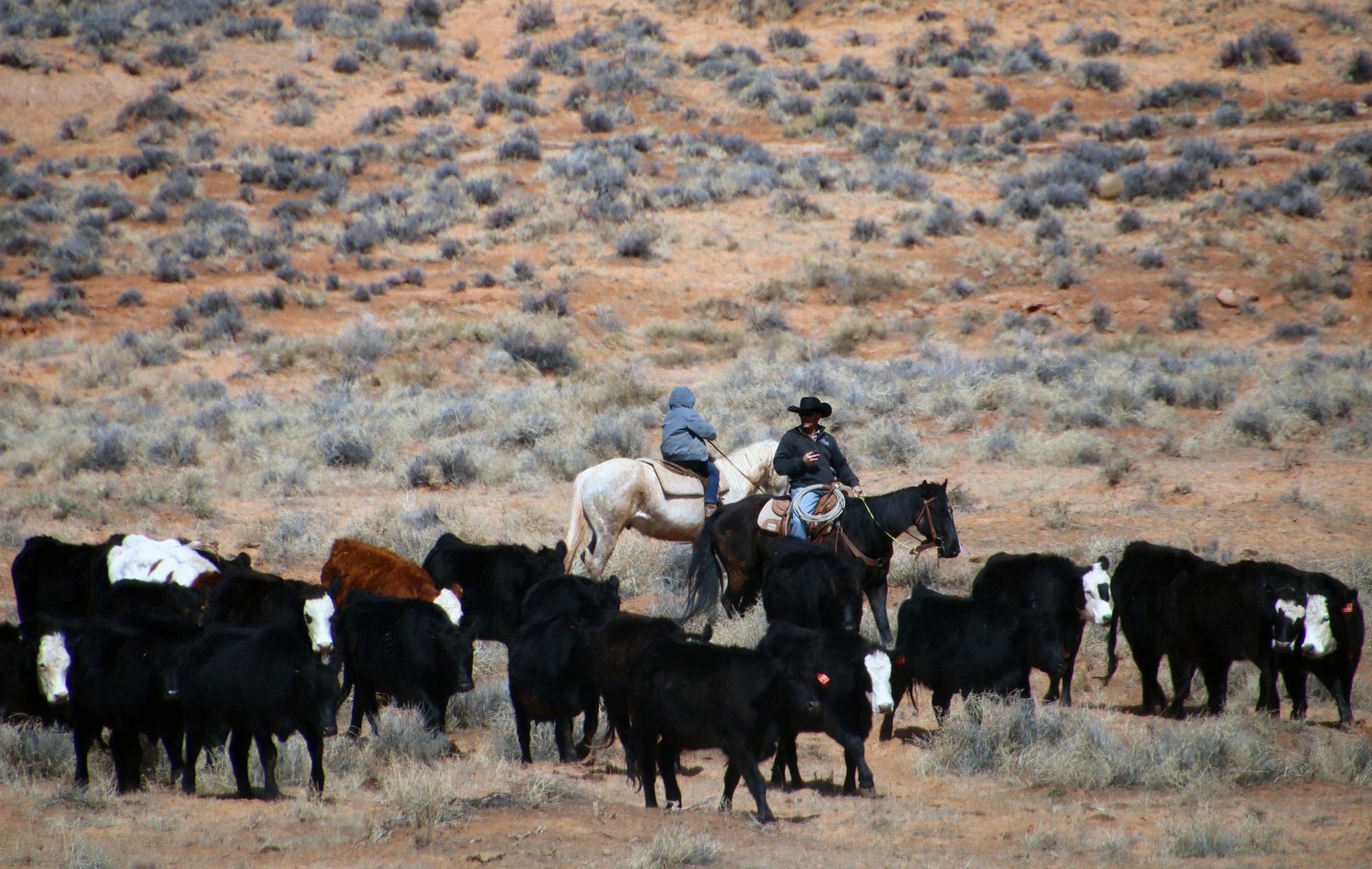
I promised a while back to take a closer look at the U.S. Department of Agriculture’s plan to “Fortify the American Beef Industry.” I did, and my conclusion is that it’s a bunch of bunk. Okay, maybe not all of it: There are some parts about enforcing “Product of USA” labeling, and about supporting small processors by reducing overtime and holiday inspection fees and so forth that could be helpful to your friendly, local meat processor.
Curiously, however, the plan’s main emphasis is on grazing on both Forest Service and Bureau of Land Management public lands, even though this makes up only a tiny portion of the U.S. beef industry. It’s almost as if the plan was driven by an ideological agenda rather than a practical one. Oh, and look at that: The Public Lands Council is taking credit for essentially formulating the grazing section of the plan! (h/t to Western Watersheds Project)
The plan will “streamline and expand grazing on federal lands, elevate grazing as an administration priority, and provide direct relief and support to American ranchers.” The plan endeavors to return livestock to vacant grazing allotments and promises to ensure that the number of livestock grazing on public lands remains steady or increases. The plan also aims to diminish protections for wild predators — including endangered ones — and make it easier for ranchers to collect taxpayer subsidies when a wolf or bear is suspected of killing their cattle.
It’s difficult to imagine how public lands grazing can be made any easier. After all, the feds have charged a measly $1.35 per month for a cow-calf pair to graze on the public’s forage for years, which is the congressionally mandated minimum. And while the “Bureau of Livestock and Mining” might go back and forth on the “mining” part of the monicker, it has retained its livestock-friendly reputation through every administration, Republican or Democratic. The agency regularly bends over backwards to accommodate livestock operations, and it often has been unable or unwilling to remove livestock from cattle-trampled lands to allow them to recover — even in “protected” areas such as national monuments.
The administration is hoping to fill up the estimated 24 million acres of vacant grazing allotments and to bolster the number of cattle grazing on public lands, but it’s not clear how that would happen. It’s not like active allotments are bursting at the seams with too many cattle: In many cases, ranchers run far fewer cattle than authorized simply because they have fewer cattle to graze and because the industry is putting more cattle on feed. U.S. beef cattle inventories have declined by more than 30% since the 1970s (along with per capita consumption), but the number of beef cows in feedlots has ballooned.
Allotments may be vacant not because the BLM or Forest Service cancelled the lease, but because the forage is of marginal quality, due to drought or overgrazing or just not great grass growing conditions, or a conservation group bought out the lease from a willing seller.
Even if the plan did increase the number of cattle on public lands, it wouldn’t make a big difference to the industry as a whole, because public lands provide less than 2% of all of the forage consumed by the nation’s 27.9 million head of beef cattle.
Sending more cattle out into desert lands to eat what’s left of the native grasses and trample more sensitive places isn’t going to “fortify” the American beef industry. It will merely perpetuate the age-old and culturally embedded practice of giving grazing incredible leeway on public lands, while benefitting only a handful of chosen livestock operators.
I’m not an absolutist on the issue; I don’t believe that all public lands grazing should be outlawed. But it should be limited to appropriate places and at appropriate levels, and should be halted before it wrecks a particular landscape. Plus, ranchers should pay a reasonable amount for the thousands of pounds of taxpayers’ forage their cattle consume each month, along with a bit extra for the externalities, with which public lands grazing is rife. This sensible type of management simply is not occurring presently, as can be witnessed on just about any tract of active BLM “rangeland” in the Four Corners Country, where fragile desert streambeds are being sullied and valuable cryptobiotic crusts decimated by herds of thousand-pound beasts.
***
If the administration was really interested in helping these ranchers, it would support a “just transition” away from public lands grazing, which is on the decline despite the government’s efforts to prop it up. That would include backing the Voluntary Grazing Permit Retirement Act, which was recently reintroduced in Congress by Rep. Adam Smith, a Washington Democrat.
The legislation would allow conservation groups to buy out federal grazing allotments from willing ranchers and livestock operators, after which the BLM or USFS would permanently retire the allotment.
While private entities can and do buy out leases currently, there is no guarantee that the leases will remain cattle-free, which is what would allow the administration to re-cow some of those vacant leases mentioned above. The proposed legislation would fix that, making the retirement permanent. The resulting certainty would encourage conservation groups to invest more in the buyouts, which would benefit the ranchers, who may be looking to get out of the business or out of a specific grazing allotment.
🤖 Data Center Watch 👾
Certain aspects of the film Eddington just keep jumping off the screen into real life. The movie, if you haven’t seen it, is about a small town in southern New Mexico where a gargantuan tech firm, SolidGoldMagiKarp, has chosen to site a data center during the height of the COVID epidemic. There’s also a conflict between a mask-denying sheriff and a slightly more high-falutin’, charismatic mayor (who supports the data center and its purported economic benefits). A lot of drama ensues — most of it not directly related to the data center — which leads into a bloody, over-the-top machine-gun battle, which, it turns out, does have ties to the data center (which ultimately gets built, because: big money).
So far data centers haven’t provoked warfare of the kind in the movie. But they are spurring a lot of conflict in the desert over their potential water and power use. There’s Project Blue in southern Arizona, which promises to add enough electricity from renewable sources to Tucson Electric Power’s grid to offset its projected enormous power use, but a lack of specifics invites skepticism. Project Jupiter, the gargantuan data center campus planned for Santa Teresa, New Mexico, says it will generate its own power, but hasn’t specified how — except that it’s not likely to use nuclear reactors because they couldn’t come online quickly enough.
Now there’s another proposal, this one for New Mexico’s Permian Basin. New Era Energy & Digital wants to build a hyperscale, AI-processing data center complex in Lea County. It, too, will build dedicated generation: A whopping 2,000 megawatts of capacity from gas, and 5,000 MW from nuclear, according to a Power magazine report. That’s an insanely huge amount of electricity. Palo Verde nuclear plant near Phoenix has a nameplate capacity of 3,937 MW and Diablo Canyon in California has 2,236 MW of capacity.
Take a moment to digest that: This proposed data center would gobble up more electricity than two of the West’s largest power plants combined could generate, which is enough to power some 2 million homes. These numbers are terrifying, but they also strain belief and reinforce the suspicion that the AI-data center boom is actually just a hype-inflated bubble that’s poised to burst before most of these facilities are ever built.
If New Era does advance its plan, it’s likely to encounter resistance (along with support) of the kind that could spark some cinematic conflict. A natural gas plant of that size could burn methane from oil wells that might otherwise have been flared off, but it will also emit carbon dioxide and other pollutants. And the nuclear reactors will produce radioactive waste, which likely would be stored onsite, something that even those accustomed to oilfield pollution might not be too enthusiastic about.
Meanwhile, the firm’s only disclosure about potential water use for cooling is that it chose the location in part for its “abundant water supply,” which is odd given the fact that the Ogallala aquifer on which the region depends is being depleted rapidly. The only kind of water that’s abundant in those parts is produced water, the briny, contaminated liquid waste that comes up from oil wells at a rate of at least four barrels of water to each barrel of oil.
⛏️ Mining Monitor ⛏️
Anfield Resources went ahead and broke ground on its Velvet-Wood uranium mine in the Lisbon Valley in southeastern Utah last week, and claims it will be producing ore by the middle of next year. That’s despite the fact the firm has yet to submit its plans for a water treatment plant to state regulators. Also, the state has not approved Anfield’s proposed reopening of its Shootaring mill near Ticaboo, Utah, which is where the ore would be processed. Anfield officials told the Moab Times-Independent that they are unlikely to send ore to the White Mesa Mill near Blanding.
***
Atomic Minerals says it has received Bureau of Land Management approval to drill more exploratory holes at its Harts Point Uranium Project just outside Bears Ears National Monument and adjacent to the Indian Creek climbing area and the Needles District of Canyonlands National Park. The new drill holes will be just over two miles from the Dugout Ranch and Canyonlands Research Center.
***
The Trump administration has added 10 new minerals to the U.S. Geological Survey’s critical minerals list, including copper, potash, and uranium. This doesn’t automatically mean a whole lot, but it will potentially give federal and state agencies and regulators yet another reason to fast-track mining proposals.
🗺️ Messing with Maps 🧭
One of the reasons I like looking at old maps and including them in these dispatches is that they provide a snapshot of how people, or at least the mapmakers, saw the region. Usually I put maps here that are at least a century old, simply because the changes they reveal are so dramatic.
When someone posted this 1940 Rand McNally map of Utah on Facebook the other day, the most remarkable thing at first glance was that it included the proposed Escalante National Monument (which is why they posted it). But as I looked more closely, I realized that this map was made just as the West was about to go through a major transformation. Over the ensuing few decades the population of the region would explode as the post-war migration and uranium, coal mining, oil and gas, power plant building, and dam building booms swept across the West.
Roads were built, small communities virtually vanished, and the landscapes and cultures were altered — along with the maps. These outtakes from the old map gives a glimpse of what the place was. For best viewing, click on the image and it will take you to the website. Click again and it should show you a larger version.
On the top outtake, notice the proposed Escalante National Monument, which would have stretched from Moab down to what is now Page, Arizona. By this time the proposal had been whittled down from the original concept, which also would have included much of what is now Bears Ears and Grand Staircase-Escalante National Monuments and Canyonlands and Capitol Reef National Parks.
Also note what is absent. The town of Page didn’t yet exist, because it was created to house workers building Glen Canyon Dam (construction began in 1956). Highway 95 followed a different route over Comb Ridge and ended at Natural Bridges NM. And the Moki Dugway road wouldn’t be built until the 1950s.

On the bottom map, note that I-15 didn’t yet exist, and the major artery through southwestern Utah, Hwy 91, bypassed the Virgin River Gorge south of St. George. I have to say, I really wish they hadn’t built an interstate through that lovely canyon. Also notable: Hildale, Utah/Colorado City, Arizona was simply Short Creek back then, and was on the Arizona side of the line (possibly where “Old Colorado City” is now?).


Speaking of data centers, have you seen Arizona's letter to Interior about the Colorado River negotiations? According to the Colorado Sun article about the negotiations, Arizona is claiming that its water rights are a matter of national security, in part because of the data centers in Arizona.
https://coloradosun.com/2025/11/11/colorado-river-negotiators-stumble-past-federal-deadline-without-joint-agreement/