

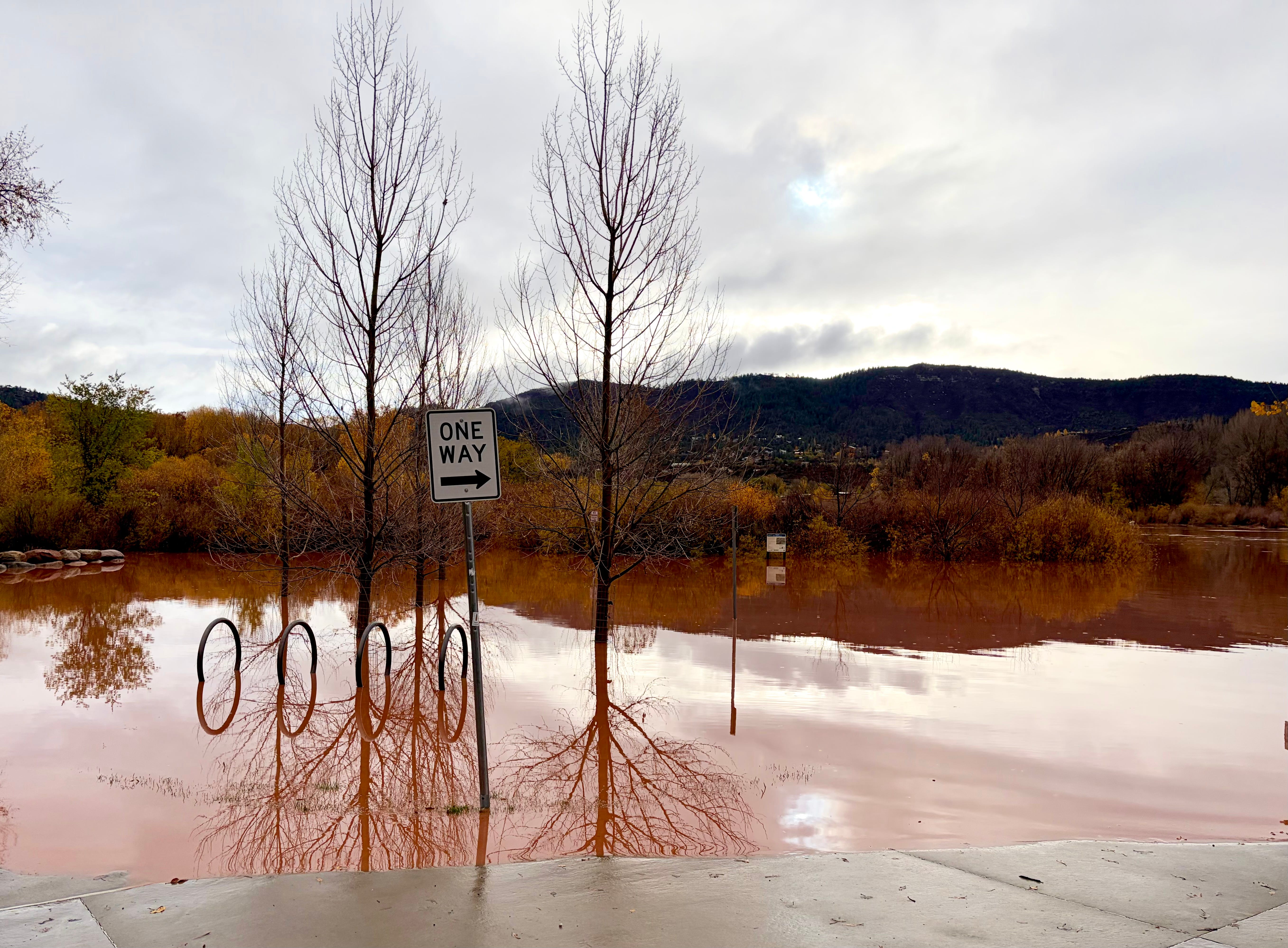
Oh, Water, you give and take away. Following one of the driest years on record, the water once again came pouring out of the sky and raging through the streams and rivers, setting new high-water records, bringing new life to the parched earth, and wreaking havoc and destruction wherever waterways and humanity intersected.
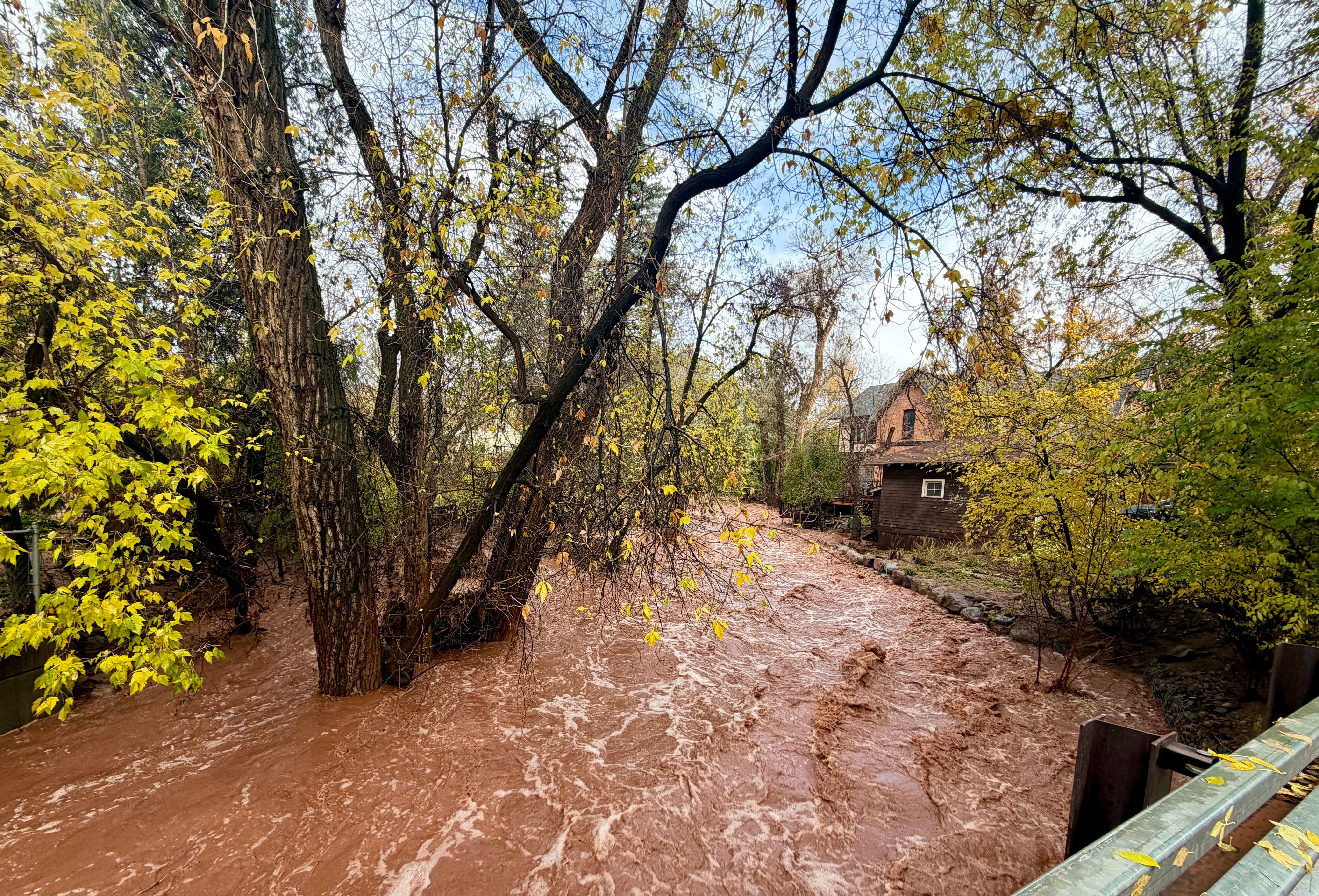
The rains stopped two days ago, but streams in southwestern Colorado continue to run at levels that would have been considered abnormally high a month ago. North of Durango, a tree careening down Hermosa Creek got wedged underneath the railroad bridge, creating a dam of sorts and forcing the muddy waters to jump the bank and run through a trailer park and neighborhoods, forcing more evacuations and closing Highway 550. Several other Durango area roads remain closed due to washouts or debris.
Other roads remain closed throughout the region. Highway 160 between Bayfield and Pagosa is shut down because the Piedra River — which exceeded 17,000 cfs yet again — washed out the highway bridge. Hwy 151 from Chimney Rock to Arboles remains closed after being wrecked by the previous flood. Hwy 160 over Wolf Creek Pass is shut, as is Hwy 17 over Cumbres Pass between Chama and Antonito. These closures have basically marooned Pagosa, which suffered serious damage during this round of flooding.
In Utah, State Road 162 north of Montezuma Creek remains closed — this is one of the stretches of road that was totally overhauled over the last couple of years. And Hwy 163 between Mexican Hat and Bluff is shut down after Comb Wash took a big bite out of the highway bridge.
Meanwhile, hundreds of affected residents are just beginning the long ordeal of cleaning up and attempting to cope with this disaster.
Having lived through a flood that filled my home with nine feet of water, I can imagine what these people have gone through, and the difficult journey they face ahead of them. It’s heartbreaking to consider, and pains me even to write it down, yet it seems necessary. (It’s equally heartening to see the communities come together to rescue and support those most affected).
After the sheer panic that hits when you realize the water is rising in your front yard; the adrenalin that sets in as you try to gather up loved ones, pets, important documents, and the phone and the laptop and wade through thigh-deep water in the yard; the elation that follows your escape and survival, comes the devastation of returning to your home, walking inside, and seeing furniture and appliances and books and possessions strewn about as if a mischievous god had picked up the house and shook it. If your home is still there, that is.
Every surface that was under water will be blanketed with fine, dense, tenacious mud. It will coat clothing. In many cases the mud itself will be tainted with sewage or other waste, and as the waters subside, a fecund odor infuses everything. Particle wood rots, drywall deteriorates, hardwoods warp, mold grows. When the mud dries it becomes quasi-sandstone that can be near impossible to remove; break it up and it turns to fine dust that is hazardous to inhale. For months or even years after the cleanup and renovations are done, people who were flooded will find the mud embedded in items or clothing.
Floods don’t discriminate, and are as likely to damage multi-million dollar homes as they are to inundate trailer parks. But the financial burden of recovery and cleanup weighs far heavier on low- and even middle-income folks. Many standard homeowners insurance policies do not include flood insurance, and your average homeowner or renter is likely to forego supplemental flood coverage because it’s very expensive, especially for homes in historic floodplains or near waterways.
I’d like to believe this was an anomaly, something we can look back on as a sort of freak occurrence that, eventually, will be so unusual that it will feel as if it were unreal, something that became exaggerated by the passing of time. The 1911 Flood feels that way to me sometimes. How is it possible that the Animas River carried nearly twice the flows we saw on Nov. 2? Surely that could never happen again. Right?
And yet, we know this was not an anomaly because the early November deluge was the fifth abnormally high precipitation event of the previous six weeks, which was capped off by two record-breaking, catastrophic flooding events. On the one hand this is historic, unprecedented, a once-in-a-century event; on the other hand it could become nearly routine in our rapidly changing climate.
Either way, if my experience is any indication, one thing is almost certain: The people affected by these floods will feel a tinge of anxiety every time the weather forecast calls for heavy rain.
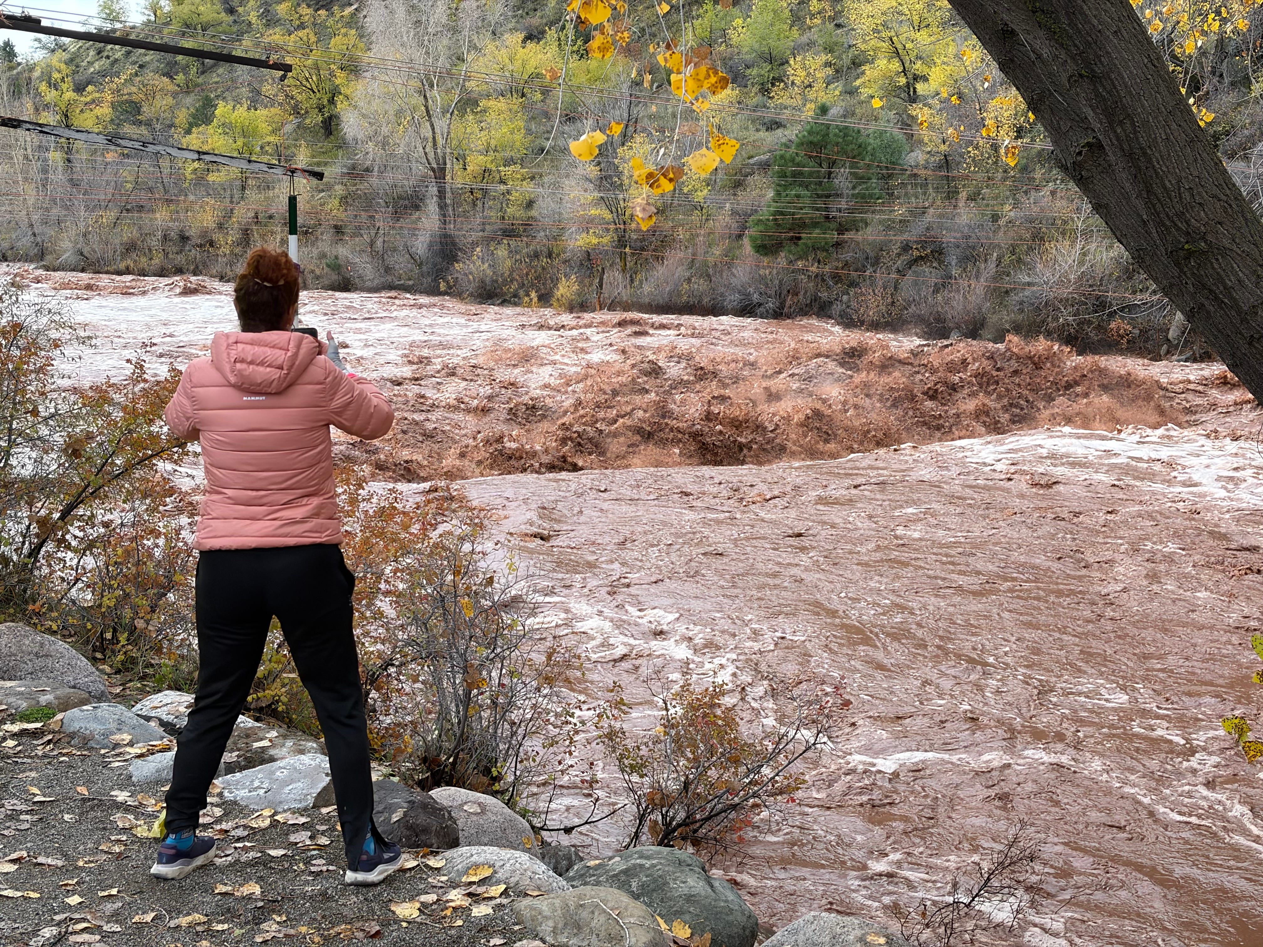
The second flood of 2026 (and water year 2027) was the third largest on record at the USGS streamflow gage on the Animas River in Durango, with a peak flow of 13,000 cubic feet per second. That puts it ahead of both 1949 and 1970, but still well behind both 1911 (water year 1912) and 1927.
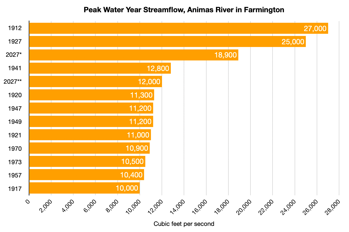
It’s interesting to see how the Animas River’s streamflows change over the course of the 45 miles or so between the Durango gage and the Farmington one. On Nov. 2, the Animas appears to have gained about 6,900 cfs over that stretch of river, while on Oct. 23 it only gained 800 cfs. A lot of this came from the two major tributaries — Lightner Creek and the Florida River — joining the Animas downstream from the Durango gage, along with numerous washes and arroyos adding their load.
Meanwhile, back in 1970 the peak streamflow in Farmington was 700 cfs lower than it was in Durango. I’m not sure how to explain that one.
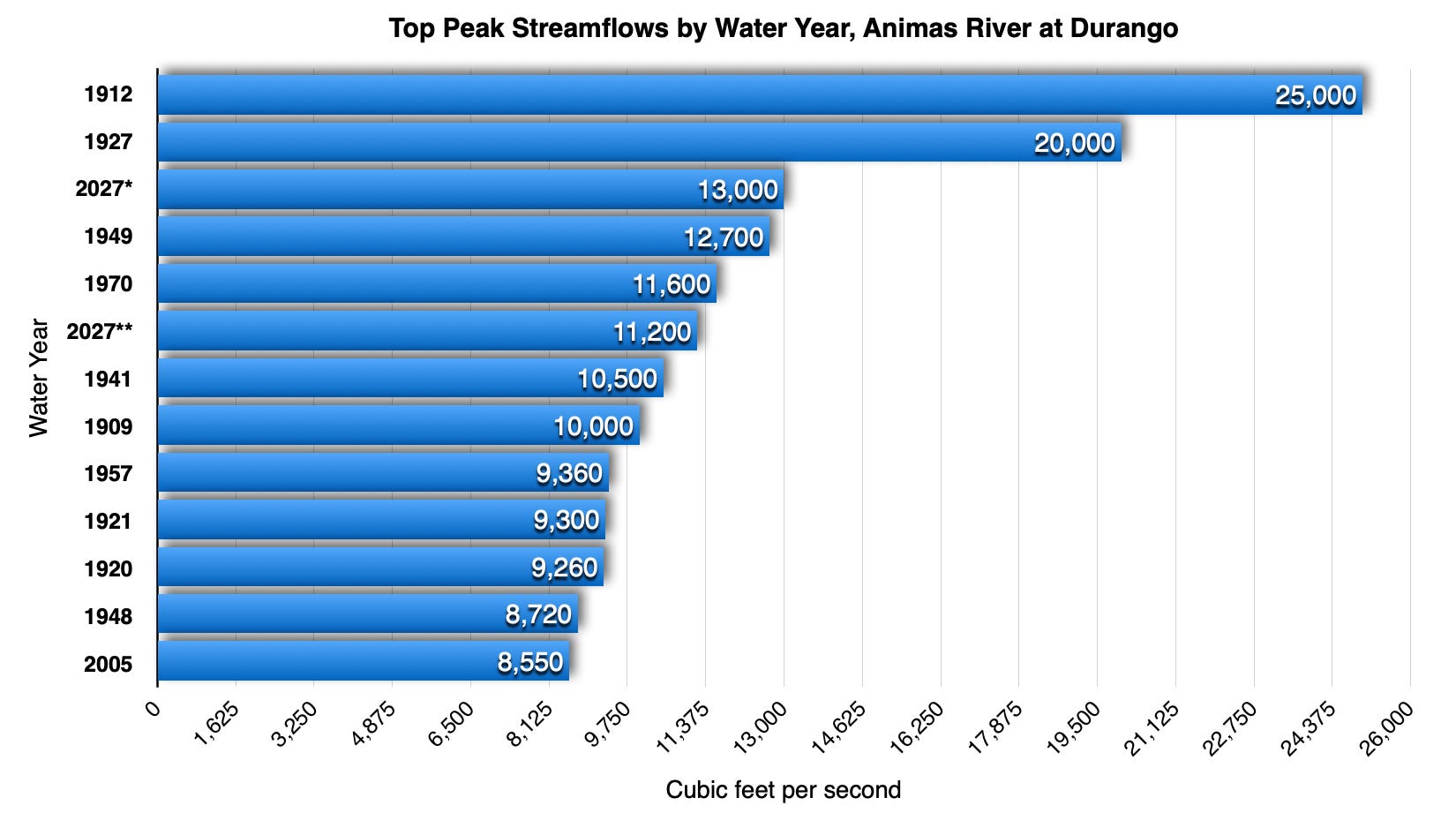
Here’s some video and commentary I made at Santa Rita Park in Durango when the river was around 12,100 cfs. It would still gain another 900 cfs before peaking later that day.