Tell me about your yukigata and your runoff peak prediction!
Also: Damn it is dry ...

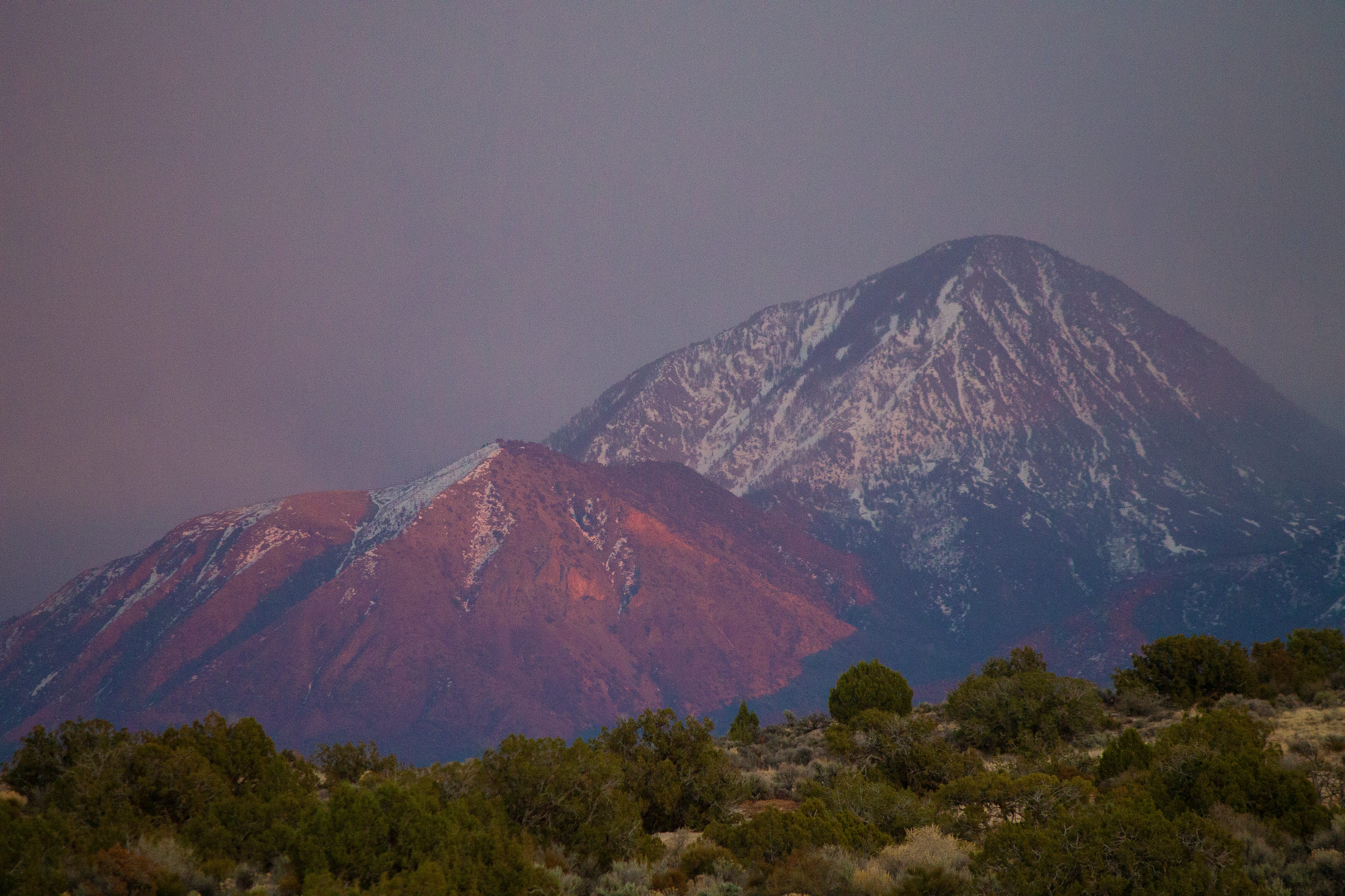
Tell me about your yukigata! No, this isn’t some weird crowdsourced kink, I’m asking you to tell me about patterns formed by melting snow on mountain slopes in the spring, or yukigata. They often serve as agricultural calendars, letting farmers know when to plant certain crops, or when the danger of a tomato-killing freeze has passed.
My grandparents, for example, ran a farm in the Animas Valley north of Durango, Colorado, for about four decades. They knew when it was time to plant by keeping an eye on the snow patterns, or yukigata, on a specific northern-facing slope on Missionary Ridge. Over in the Montezuma Valley gardeners wait until Ute Mountain is free of snow to plant. Folks along Utah’s Wasatch Front keep an eye on the Sleigh Runner crevasse on Box Elder Peak. In the Grand Valley of Colorado, it would be foolish to plant before the Swan’s Neck has melted. And in the North Fork Valley of Western Colorado, gardeners wait for the Devil’s Neck on Mt. Lamborn to “break.”
Do you have a yukigata that serves as a planting calendar or merely a sign that spring has arrived? If so, it would be great for you to let the Land Desk know — in the comment section or via email to landdesk@substack.com — how it’s doing right now and how that compares to a “normal” snow year. And if you used the yukigata as a planting calendar, is it still reliable?
Over the last couple decades, yukigatas have been disappearing sooner than in the past, tricking people into planting too early and making their crops vulnerable to the inevitable spring freeze. In Durango, Colorado, for example, gardeners once planted according to when the snow melted off the north face of Smelter Mountain, which could be as late as Mother’s DAy. This year what little snow fell on the mountain was gone by early March, which seems dangerously early to put freeze-sensitive plants in the ground.
This also messes with plants’ internal calendars, tricking fruit trees into blossoming too early. A 2022 study found wildflowers in the sagebrush ecosystem now bloom weeks earlier than they did in the 1970s. And here’s a cool map from the National Phenology Network showing where trees leafed out earlier (or later) than usual this year.
🚣🏽 Predict the Peak 💧
It’s kind of a depressing year to have a predict the peak runoff contest, I know. But the show must go on, so here goes.
First off, the rules:
Only predictions entered into the Land Desk comment section on this or another dispatch will be eligible for prizes. Only paid subscribers can enter comments, meaning if you want to play, you should upgrade to paid, either on a monthly or annual basis or via a free trial.
Entries must be received before April 3, 2026, to be eligible for prizes (That’s soon, I know, but I figure some streams may be peaking in April, so I wanna make sure it’s a prediction, not an observation … ). And yes, it’s possible that some of these streams have peaked already; it’s fine to backdate your predictions.
The contest will be held for four river gauges (listed below), chosen because they are not significantly influenced by upstream dams or diversions. Eligible entries must include a predicted high spring flow, in cubic feet per second, and the date of the peak. The predicted flow nearest the actual peak will be the winner for each gauge. The date will be used as a tie-breaker.
The winner for each gauge will receive a piece of Land Desk merchandise. If the same person wins for multiple gauges, they will receive multiple prizes.
The Land Desk will make the final call on winners after the streams have clearly reached their respective spring peaks (i.e. when the snow in the feeder watershed is all gone). I fear this may be sooner than later this year, but who knows?
The river gauges are:
The Animas River in Durango, Colorado: https://waterdata.usgs.gov/monitoring-location/USGS-09361500/
The San Miguel River at Uravan, Colorado: https://waterdata.usgs.gov/monitoring-location/USGS-09177000/
The Yampa River near Maybell, Colorado: https://waterdata.usgs.gov/monitoring-location/USGS-09251000/
San Juan River at Carracas, Colorado: https://waterdata.usgs.gov/monitoring-location/USGS-09346400/
My preliminary predict the peak for the Animas has already been proven wrong. I thought, based on this year’s snowpack vs. 2002’s, that it would top out at 700 cfs on April 15. Well, on March 27 it reached 992 cfs. So, yeah, I was wrong.
I guess this is good news for early season kayakers who managed to stow their skis and dust off their boats quickly enough to take advantage of the high flow, but it’s not so great for everyone else. Cooler temps should slow the melt a little bit, but without some good April storms there may be now snow left for the traditional spring runoff in May and June, leaving sparse pickings even for early season rafters.
***
I wanted to include the Dolores River at Dolores (just above McPhee Reservoir) in this contest, but I’m thinking it will probably peak this weekend. It’s really remarkable, and pretty damned scary, how fast and early that watershed has melted out. Here are the charts.


Though the top graph doesn’t show it, there still is a little bit of snow left in the watershed to melt, and there could be more on its way. Nevertheless, the combination of the early peak, the scant snowpack, and the relatively low reservoir level is looking grim for the irrigators that rely on water from the Dolores. There was far more snow and more water in the reservoir at this time in 2021, the year that the Ute Mountain Ute farms received just 10% of their share of McPhee water, forcing them to fallow many of their fields. Dove Creek’s municipal water supply is also vulnerable to shortages, as are the former-drylands farms in that area.


A boating release from McPhee into the Lower Dolores is out of the question, meaning yet another year of a mere trickle making it downstream, imperiling fish, aquatic life, and the entire riparian ecosystem. Unless, that is, the Bureau of Reclamation decides to empty all reservoirs upstream of Lake Powell in order to keep that reservoir from dropping to de facto deadpool. That scenario seems unlikely, yet without a serious reversal in the climatic trends, drastic measures may be necessary to protect Glen Canyon Dam’s plumbing in the near term. As for the long-term? Well …
***
Why did the Bullfrog cross the river? To get to the deeper water. Okay, that’s dumb. Anyway, I ran into this headline the other day at KSL.com:
Bullfrog Marina to be temporarily relocated amid Lake Powell’s water woes.
Bullfrog Marina is located on Bullfrog Bay, an arm on the west side of Lake Powell. The bay is shrinking as water levels plummet, making the boat ramp and the marina in general less and less viable. So, they’re planning on moving the operation across the lake to the east side, near Halls Crossing marina, where the water is deeper and less vulnerable to lake level fluctuations.
It should be interesting to see how this affects visitation. The folks who usually go to Bullfrog for boating would now presumably go to Halls Crossing, which is about 105 miles further for those coming from Hanksville (since the Halls Crossing-Bullfrog ferry is also out of commission due to low water). Last year, the Bullfrog District of Glen Canyon National Recreation Area had 114,000 visitors, while Halls Crossing had only 26,500 visitors. This is significantly less than the southern parts of the reservoir; Wahweap had 1.4 million visitors last year.
How this plays out may be an indication of if and how visitation patterns are changing at Lake Powell. It does seem like fewer people are boating and more are sightseeing, hiking, or using smaller watercraft (kayaks, SUPs) that don’t require boat ramps. Maybe Bullfrog — and neighboring Ticaboo — won’t see a huge drop in visitors.
It may only be a temporary situation, even if the reservoir doesn’t recover: The National Park Service is working on building a low-water friendly boat ramp near Bullfrog at Stanton Creek, but it won’t be finished this summer. Now the question is whether it will be finished before the reservoir disappears altogether.
⛏️ Mining Monitor ⛏️
Metallic Minerals’ plan to mine the La Plata Mountains likely would affect multiple watersheds, including the La Plata, the Mancos, and the Upper Dolores. If it ever comes to fruition, which is still a big if, it won’t be for a long time from now. However, the company is doing exploratory drilling, which has impacts of its own, including on water supplies and, potentially, water quality.
If you’re in southwestern Colorado and would like to learn more about the project from the mining folks, themselves, you can do so at a handful of public meetings in coming days. Here’s the schedule:
🗺️ Messing with Maps 🧭
I must admit that I’m somewhat enamored with the Copernicus Browser, which allows you to look at relatively high resolution satellite imagery on any chosen date. This allows you to easily compare changes to the landscape, for example, or to be able to see how this year’s snowpack compares to last year’s. NASA’s Worldview is similar, but with slightly different capabilities: The imagery isn’t as clear, but it allows you to zoom out and also has a slightly better snapshot/download function, in my opinion.
These images are from NASA Worldview, and show southwestern Colorado at the end of March 2023 and 2026. Keep in mind that 2023 was an unusually snowy year, especially later in the season. Still, the difference is stark. The little orange-red marker is Cortez; Durango is on the far right of each image (Lake Nighthorse is more visible than the town, itself).


Here in the Roaring Fork Valley the saying is that you don't plant your tomatoes outdoors until the snow is off the "whales tail" on Mt. Sopris. That snow is long gone, but I still wouldn't put out the tomatoes quite yet...
Here in northern NM I expect the Rio Grande to peak next week at less than 1000cfs at Otowi. Fact is, we may have already peaked and peaked at less than 700cfs but .... just for fun I'm gonna go with 615pm, April 1 at 943cfs. Just to be specific. 🤪