

⛈️ WACKY WEATHER WATCH⚡️
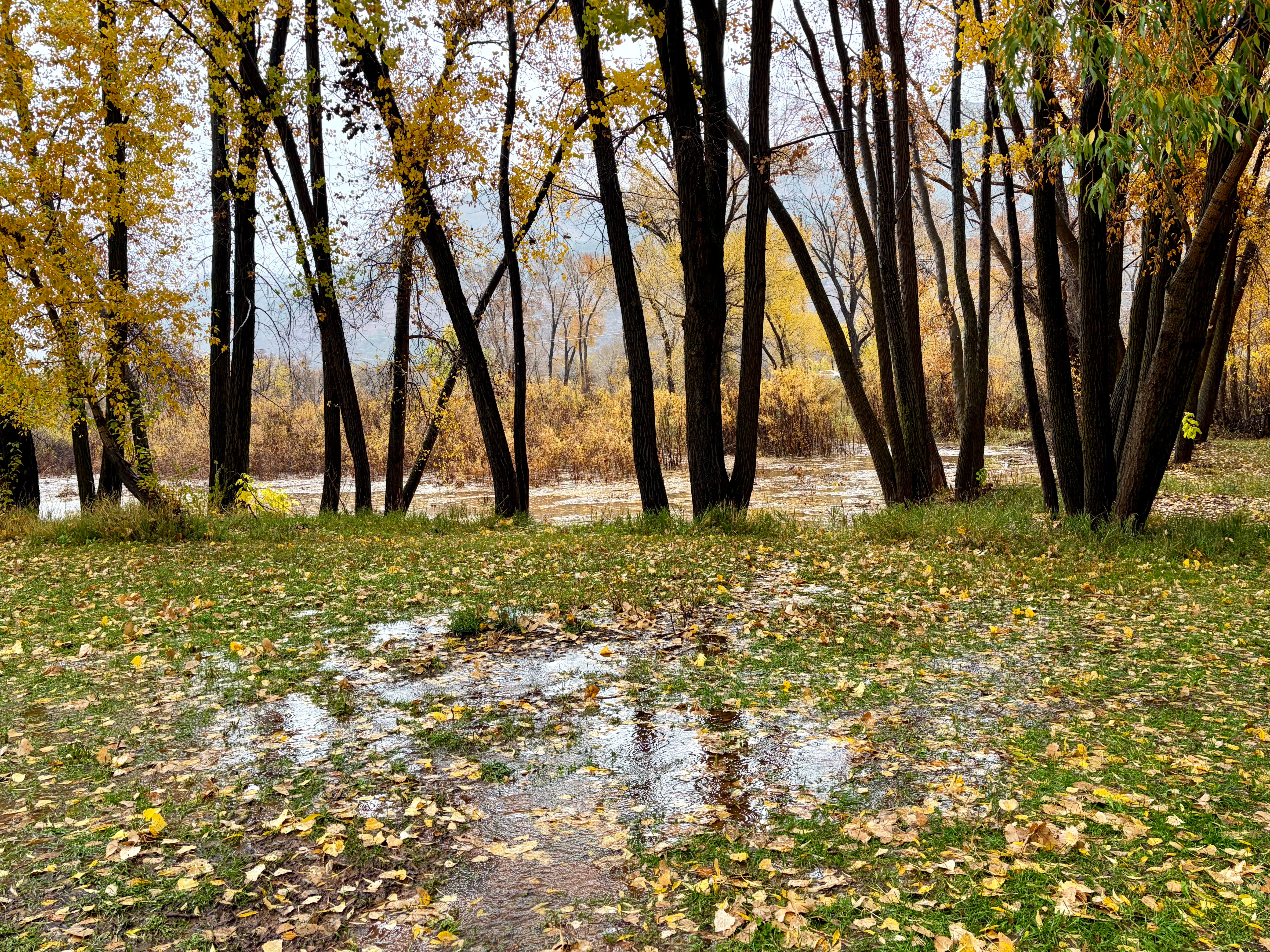
It’s Sunday afternoon, the first day of November, and if tomorrow is the Day of the Dead, today is the Day of the Deluge here where I sit, a couple miles north of Durango. A hard rain has fallen relentlessly for the past 15 hours or so, only occasionally easing up for a few minutes at a time. An hour ago, the La Plata County Sheriff sent out an alert closing all county roads due to flooding conditions. While the segment of county road I’m on remains passable, numerous other roads have shut down themselves as debris flows bring mud, silt, and high water onto the roadways.
In need of provisions, and with a journalistic desire to see what the hell was happening out there, a friend and I ventured out to find waterfalls spilling off of Animas Mountain onto the highway into town, bringing rocks and silt with them. The liquor store, abiding by the shelter-in-place order, was just closing up for the day as we arrived.
Reports poured in about flooding around town: Highway 160 just east of town had turned to a river after Lightner Creek apparently jumped its banks; Junction Creek also was flooding, affecting some homes and forcing evacuations. To the south, San Juan County, New Mexico’s Office of Emergency Management urged all residents within a half mile of the San Juan, Animas, and La Plata rivers to head to higher ground. As the text alerts reached phones, and the serious of the situation became apparent, the roads emptied out.
So far, the flooding is mostly limited to arroyos and smaller waterways, but the major rivers continue to rise. Parts of Pagosa Springs and surrounding areas along the San Juan River are under a mandatory evacuation order as I write this, and the river is forecast to crest around 19.71 feet, or about four feet higher than the Oct. 23 peak (9,100 cubic feet per second). If it reaches that point, it will not only cause catastrophic damage, but would also be larger than the 1911 flood, making it the largest on record, by far.
Even if the river levels don’t meet or exceed those of October 1911, this autumn’s deluges are still historic. Autumn storms and floods are not uncommon in this area. But to have a succession of storms this big, dumping this much moisture, and bringing multiple rivers and streams to record or near-record levels over just a few weeks, is very unusual and possibly unprecedented, at least over the last 130 years or so. It’s also extraordinarily challenging for those who live in the path of these rivers, arroyos, and streams — people who are only beginning to muck out the sewage-tainted silt from the last flood a week ago.
Also somewhat freakish is the timing: Flooding on Nov. 1 is odd because typically the moisture would be falling as snow by this time of year, which would keep the moisture on the ground rather than in the streams. Yet as of Sunday afternoon, it was still coming down as rain and Schneeregen up to about 11,000 feet in elevation, melting existing snow and leading to big streamflows in high country creeks and rivers. The snow-line is expected to drop considerably later tonight, snarling travel while also creating a nice base for the snowpack. If it comes soon enough, it may even keep some of that moisture out of the streams — at least until next spring, when it’s needed.
In the meantime, we sit and wait and watch nervously to see what the rivers will do.
Some notable streamflow data from around the region, as of Nov. 1 at about 5 p.m. (keeping in mind this is all provisional, real-time data):
McElmo Creek near the Colorado-Utah state line hit 1,610 cfs at 2:45 pm on Nov. 1, which is about 30 cfs higher than the Oct. 22 high mark.
The Piedra River near Arboles was at 16,800 cfs at 8 p.m. on Nov. 1, just 200 cfs short of its peak during last week’s floods (when the gage was knocked out of commission).
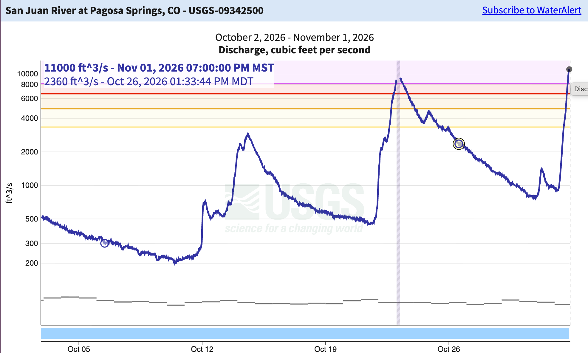
The San Juan River at Pagosa Springs was at 11,000 cfs at 7 p.m. — 2,000 cfs higher than last week’s flood — and still rising. The gage height is on track to exceed 1911’s, though it’s not yet clear that the streamflow will beat 1911’s 25,000 cfs. Either way, it will be devastating.
The Animas River at the gage in Durango was at 4,790 cfs and still rising at 4:30 p.m. At the same time, the gage just downstream (below the confluence with Lightner Creek) 7,010 cfs, indicating that Lightner Creek was somewhere around 1,200 cfs (there’s no gage on that stream).
That’s nothing compared to what was going on further south and west …
Oak Creek near Cornville, Arizona, jumped from 165 cfs to over 27,000 cfs in a matter of hours on Nov. 1.
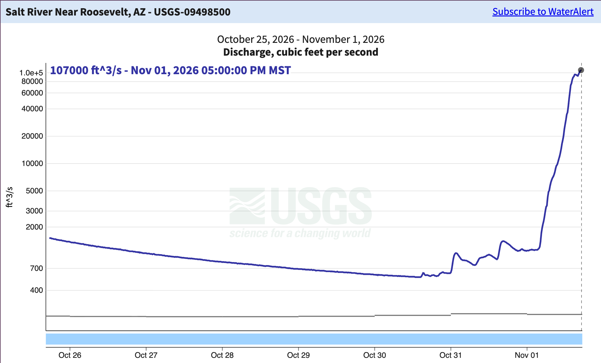
The Salt River just upstream from Roosevelt Reservoir was at 107,000 cfs and rising at 5 p.m. on Nov. 1. That’s an insanely huge amount of water. It’s also the third highest flow on record in over a century.
The Agua Fria River near Rock Springs, Arizona, was virtually dry a few weeks ago. Today, it reached 22,900 cfs.
The Verde River below Tangle Creek in central Arizona was at 89,000 cfs at 6:14 p.m. on Nov. 1.
That’s it for now. I’ll be trying to put this all into context if and when the waters subside …
Be careful - Be safe