The Land Desk

Share this post

News Nuggets

www.landdesk.org

News Nuggets

Oak Flat redux; Klamath dams going down; Chaco drilling ban advances

Jonathan P. Thompson
Nov 18, 2022
1
Share this post

News Nuggets

www.landdesk.org
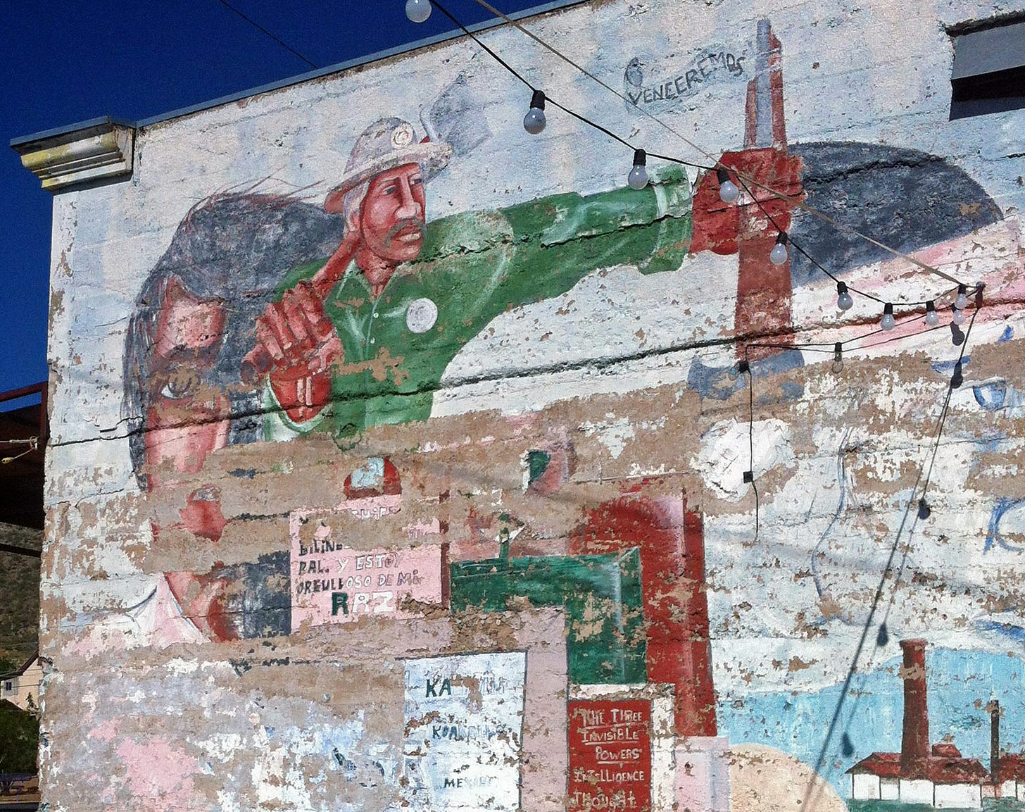
A mural in Superior, Arizona, near Oak Flat. Jonathan P. Thompson photo.

A federal appeals court has agreed to again consider Apache Stronghold’s bid to block a massive copper mining project proposed for Chi’chil Biłdagoteel, aka Oak Flat—a boulder-studded plateau near Superior, Arizona, that has historical and ceremonial significance to the Apache people and other Southwestern tribes. Three judges from the court previously ruled against the nonprofit, but this time a full slate of eleven judges will hear Apache Stronghold’s argument that privatizing and destroying Oak Flat with mining and resulting subsidence would violate the Religious Freedom Restoration Act.

The mine would be underground rather than open pit, but the environmental analysis estimates it would result in a 1.8-mile diameter subsidence crater at Oak Flat between 800 and 1,115 feet deep. On top of that, the mine will produce a 200-foot high tailings pile that will cover from 2,000 to 6,000 acres of public land, potentially blocking public access to over 10,000 acres of public land. Tailings are filled with sulfides which react with water and air to form sulfuric acid, which then mobilizes toxic metals that can wash into streams and arroyos. Meanwhile, the mine will use hundreds of billions of gallons of water over its lifetime in an area that really can’t afford it, affecting springs, groundwater levels, and area streams. 

Upgrade to Paid Supporter


Oil and gas development just outside the proposed Chaco buffer zone. Jonathan P. Thompson photo.

The U.S. Interior Department is moving forward with a plan to halt new oil and gas leasing in an area around Chaco Culture National Historical Park, which includes publishing an environmental analysis of the proposal. Its findings include:

  • The proposed withdrawal of public land from mineral leasing would result in 47 fewer oil and gas wells being drilled over the 20-year withdrawal period;

  • and about 4.1 million fewer barrels of oil and 75 million mcf of natural gas being produced during that time. While that may sound like a lot, it’s less than is produced in the Permian Basin every day.

  • The proposed withdrawal would result in a 5.3% drop in mining sector employment in the region and reduce oil and gas-generated gross receipt taxes by about 11%. But that could be offset by an increase in visitation and tourism due to reduced industrialization.

  • The withdrawal would only minimally affect Navajo allottees in the area, since those lands would remain open to leasing.

Read more about the buffer zone:

The Land Desk
News Roundup: Chaco buffer zone inadequate
Sen. Martin Heinrich, D-New Mexico, last week urged Interior Secretary Deb Haaland to make permanent a ten-mile oil-and-gas buffer zone surrounding Chaco Culture National Historic Park. Community advocates want more. “Removing federal minerals from …
Read more
2 years ago · 3 likes · Jonathan P. Thompson

In related news:

A 5.3-magnitude earthquake—the largest in the region’s history—shakes the Permian Basin oilfield in southeastern New Mexico and western Texas. The region has experienced an increase in seismic activity alongside increased drilling activity in the oilfield. The quakes are likely caused when massive quantities of oil and gas wastewater—aka produced water—are injected deep into the earth.


Geeking Out On Maps

A new global nonprofit has released a cool tool for tracking greenhouse gas emissions across the world. Climate Trace’s map allows one to scroll around and click on individual power plants, oil and gas fields, or even feedlots to see how much carbon dioxide, methane, or carbon dioxide-equivalent each emits annually. It even allows you to choose between a 100-year and a 20-year time frame, which is critical since methane is far more potent over the short-term. One alarming stat from the map: The Permian Basin is the world’s largest methane emitter.


Mining Rush Tracker
  • Canada-based Atomic Minerals Corporation continues to snatch up public land in the form of mining claims. The company announced last week that it “acquired by staking” (note: They don’t actually acquire the land, just the right to mine it) 10,400 acres of federal land northwest of Moab, Utah, in what it calls the 10 Mile Property. A company press release says they targeted the area because it geologically resembles the uranium-rich Lisbon Valley Anticline and Big Indian Mining District.

  • United Lithium says it has staked 300 lode claims covering about 5,800 acres near Ohio City, Colorado, about 17 miles east of Gunnison. The claims are in a mountainous area on U.S. Forest Service land that saw mining activity in the 1940s and 1950s. A company press release says it is planning an exploration program on the claims once permits are in place.


Big News!

The Klamath River dams are coming down, at last, giving the imperiled salmon another chance at survival. Read B. “Toastie” Oaster’s scoop for High Country News.

More here:

Twitter avatar for @Sammy_Roth
Sammy Roth @Sammy_Roth
It's official: The Klamath River dams are coming down. Four dams along the California-Oregon border to be demolished at a cost of $500 million, marking the largest dam removal project in U.S> history: latimes.com/environment/st… via @whereishayley
latimes.comIn ‘momentous’ act, regulators approve demolition of four Klamath River damsFederal regulators have approved a plan to demolish four Klamath River dams, a historic act that is intended to save imperiled salmon.
1:38 AM ∙ Nov 18, 2022
104Likes43Retweets

Why not here? department

France just enacted legislation requiring all parking lots with 80 spaces or more to be covered with solar panels. The government estimates it could result in up to 11 gigawatts of additional generating capacity, equivalent to about 10 nuclear plants.

If France can get 11 GWs out of that, then just think of what the U.S. could do by covering parking lots—and, while we’re at it, big box stores—with solar panels? We’re talking hundreds or even thousands of gigawatts, obviating the need to build the things in the desert.


Colorado River Compact sans Context

“Nor can one make great oratory out of the fact that there is ample water and to spare after the apportionment of enough water to each basin in perpetuity to cover all of the present uses plus all of the known feasible projects, plus 20 percent for good measure. Yet, behind all the precise and commonplace language of the compact lies the greatness and romance of the West, the building of a million more homes out under the blue sky in security and good will.”

— Secretary of Commerce Herbert Hoover after the compact was signed 100 years ago this month, in what may have been one of the most ignorantly optimistic, and least sagacious, statements regarding the foundational document. Read more about the how the compact hasn’t aged so well in my analysis for High Country News.


Parting Shot
An angler fishes the San Juan River below Navajo Dam on a chilly November day. Jonathan P. Thompson photo.

Share this post

News Nuggets

www.landdesk.org
Previous
Next
Comments
TopNewCommunity

No posts

Ready for more?

© 2023 Jonathan P. Thompson
Privacy ∙ Terms ∙ Collection notice
Start WritingGet the app
Substack is the home for great writing