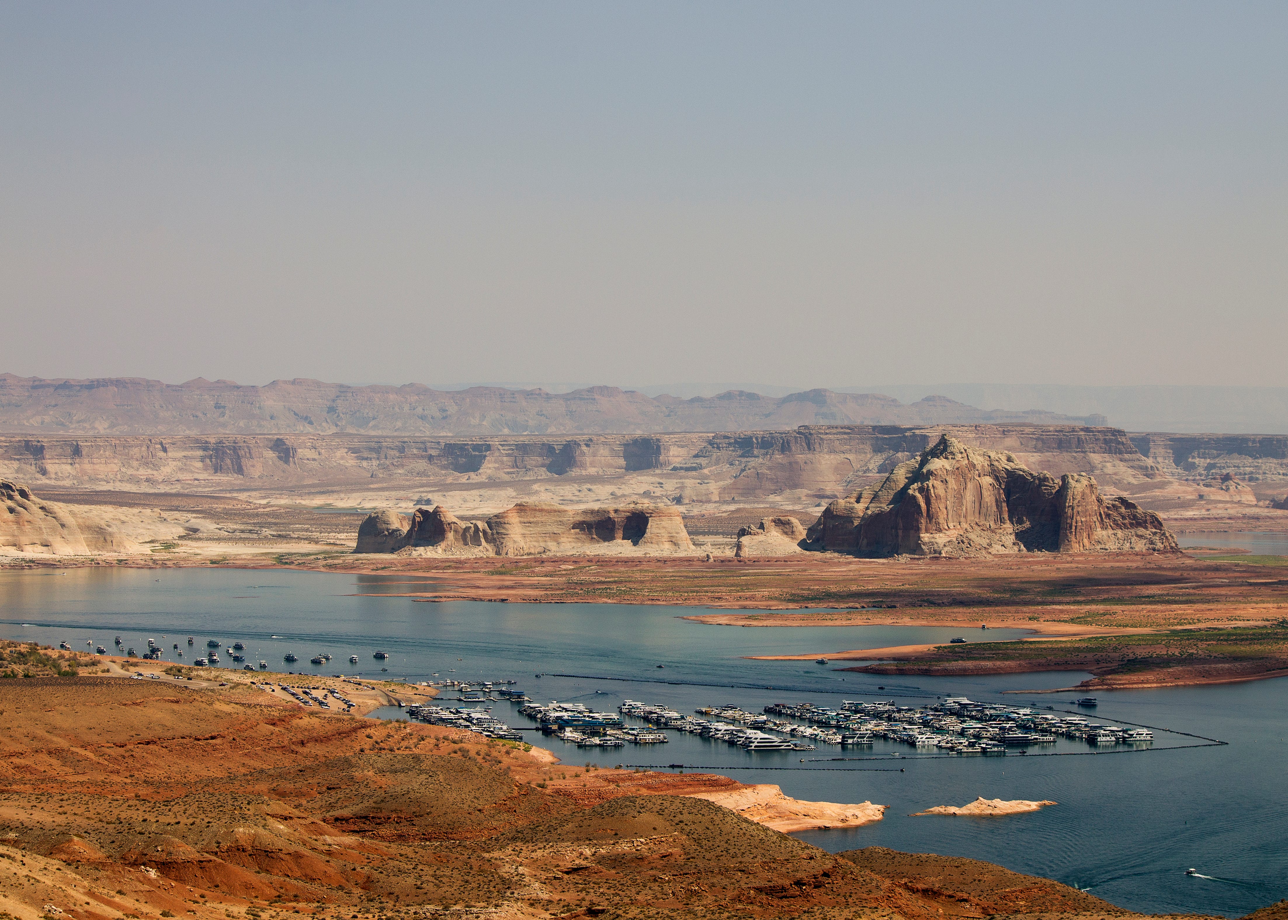
Feds release Colorado River plan, and no one's very happy about it
š Colorado River Chronicles š§

Last week, the federal Bureau of Reclamation released their final environmental impact statement for proposed alternatives for managing the Colorado River and its major reservoirs over the next decade. The preferred alternative is not a specific operating plan, but is the ādecision frameworkā that will provide a structure within which those plans can be developed at two-year intervals. The operating guidelines for the 2027 water year, which begins Oct. 1, are expected to be released later this month.
The feds stepped in after the seven Colorado River states failed to agree on a new plan to replace the 2007 Interim Guidelines and the 2019 Drought Contingency Plans, both of which expire at the end of September. The states will continue to negotiate, and a seven-state consensus deal would take precedence over the federal plan.
Those plans were aimed at bringing overall demand back into balance with supply, which is not easy given that a warmer and drier climate is continually diminishing the already over-allocated river. While the document appears to have been completely scrubbed of any references to āclimate changeā or āglobal warming,ā it does obliquely acknowledge that the cause of the current woes is a heating planet with passages like this one: āImbalance between water supply and demand will be exacerbated by increasingly likely low-runoff conditions: The Basin is experiencing increased aridity due to climate variability, and long-term drought and low-runoff conditions are expected in the future.ā

While the supply-demand balance is the central objective, a secondary one is to āprotect critical elevationsā at Lake Powell, which is to say they will take significant measures to keep the surface level from dropping below 3,500 feet, which provides a 10-foot buffer above minimum power pool. This not only preserves hydropower output, but it also avoids relying on the river outlet works for sustained releases. Meanwhile, the feds didnāt even consider proposals to drain Lake Powell or to build bypass tunnels around Glen Canyon Dam to allow for low-level water releases.

The release was met with much pomp and circumstance, along with a lot of hand-wringing and teeth-gnashing, though it didnāt contain any major surprises or changes from the draft EIS released earlier this year. The big takeaway, or at least the most talked-about one, is that the Upper Basin states will not be subjected to mandatory water use cuts, though they are being asked to cut about 200,000 acre-feet annually on a voluntary basis. The Lower Basin states, meanwhile, will be required to cut their consumption, perhaps by as much as 3.6 million acre-feet per year, depending on reservoir levels. Thatās nearly half of those statesā Colorado River Compact allotment.
The cuts would be distributed based on water right priority, which would hit Arizona the hardest. Thatās not because Arizonaās rights are junior to everyone elseās, but because their biggest straw ā the Central Arizona Project ā has junior rights, which the state accepted in exchange for federal funds to help build the thing and to help power its energy-sucking pumps.
Lower Basin leaders are, generally, livid. Arizona Gov. Katie Hobbs said the fedsā plan āstill contains unacceptable options that include the federal government forcing Arizona to take the majority of draconian water cutbacks.ā Nevada Gov. Joe Lombardo said the plan āseeks to impose unrealistic reductions on Nevada and our water users ⦠{that} could have devastating economic and environmental impacts ⦠.ā
The response from the Upper Basin has been a more measured and mixed, but is predominantly one of relief at being spared mandatory cuts. But any celebration is tempered by the fact that nature is forcing its own cuts in the Upper Basin; irrigation canals are shutting down all over the place, long before the growing season is over, and some irrigators have received only a fraction of their usual allotment this year. Plus, the plan leaves open the possibility of draining Upper Basin reservoirs such as Flaming Gorge, Blue Mesa, and Navajo to buoy levels at Lake Powell. That will affect recreation and leave less water for irrigators and other users in the Upper Basin.
Meanwhile, advocacy groups are generally unhappy about the planās short-term approach, its focus on saving dams rather than the river, its willful ignorance of climate science, and its failure to force cuts on all river users. Even more dismaying is the fact that it doesnāt even cap Upper Basin consumption at current levels, implicitly allowing new diversions and water projects that would throw supply and demand further out of balance. āThe Colorado River needs consequential and systemic change that confronts the ecological, political, and legal chaos caused by climate change and Glen Canyon Dam, but Reclamationās plan is just ālather, rinse, repeatā of past failed policies,ā said Gary Wockner, of Save The Colorado, in a written statement.
This sentiment reveals a sort of paradox on the Colorado River: All of the water that flows to the Lower Basin and the industrial-scale alfalfa farms in the Imperial Valley also runs through the Grand Canyon, keeping that ecosystem healthier. Meanwhile, any water that the Upper Basin consumes or that is held back in Lake Powell to protect the damās integrity is water that doesnāt flow through the canyon.
Thereās no indication that the Trump administration is punishing the Lower Basin states, however. Itās far simpler logistically to distribute and enforce mandatory consumption cuts in the Lower Basin because there are fewer diversion points, each of which is far larger than in the Upper Basin. Also, the 1928 Boulder Canyon Project Act made the Interior Secretary the āwater masterā on the Lower Colorado River, giving the feds greater authority to order shortages.
One question that remains unanswered is how reduced releases from Glen Canyon Dam would play out in the context of the Colorado River Compact, which dictates that the Upper Basin ānot cause the flow of the river at Lee Ferry to be depleted below an aggregate of 75 million acre-feetā for any 10-year period. Thereās a high likelihood that the 10-year aggregate flow will drop below 75 maf in the next year, giving Arizona possible grounds to sue and putting the interpretation of the clause into the hands of the Supreme Court.
Here are a few more details from the final EIS:
Glen Canyon Dam annual releases, which will be determined on Oct. 1, will range from 6 maf to 12 maf. This could drop as low as 5 maf if necessary to defend the āde facto deadpoolā Lake Powell surface level of 3,500 feet. That would reduce flows in the Grand Canyon to below 7,000 cubic feet per second, and cause Lake Mead to drop further.
The maximum shortages/cuts for the Lower Basin would be 3.6 maf distributed as such:
Arizona: 1.96 maf
California: .9 maf
Nevada .21 maf
⢠Estimated shortage impacts by water user type under various shortage conditions:
Lower Basin 2027-2028:
Tribal: 209-346 kaf
Domestic: 313-858 kaf
Non-Tribal Irrigation: 2-70 kaf
Lower Basin (2029-later)
Tribal: 241-576 kaf
Domestic: 277-1,472 kaf
Non-Tribal Irrigation: 6-829 kaf
⢠Acreage range of Indian Trust lands in the Lower Basin that would be fallowed under various shortage conditions:
AZ: 6,535 to 67,375
CA: 0
NV: 0
⢠An alarming quote about how junior water rights holders are going to face shortages no matter what: Under the preferred alternative, ā⦠for all Arizona, California, and Nevada junior entitlements (AZ CAP NIA-A and NIA-B; AZ CAP Indian, M&I, and 4(I); CA P4; and NV P8 priority groups) there are no potential futures in which >80% of normal domestic water delivery occurs.ā
⢠Lower Basin Tribal water users with present perfected rights would receive at least 80% of normal water deliveries in at least 90% of years across 2027-2039.
⢠During 75% of years under preferred alternative, Lake Powellās level would be below 3,550 feet during at least 90% of months, meaning Cathedral in the Desert would be visible and accessible.
The EISās authors summed up the challenges with all of this ā and the perils that may lie ahead ā in one paragraph, writing:
Developing new guidelines is difficult in this complex Basin, where critically low storage in Lake Powell and Lake Mead, significant hydrologic variability, and the anticipation of drier future conditions amplify the central tradeoff: balancing the potentially profound impacts of water-delivery reductions with the need to maintain reservoir storage. The alternatives in this Final EIS capture a broad range of management strategies to address this tradeoff, and they demonstrate that there are multiple ways to find a balance if conditions improve. If conditions do not improve, achieving a balance is more difficult, and, under critically dry futures, even large and unprecedented reductions may be needed and may not be enough to stabilize storage.
A Colorado River glossary and primer
After last weekās somewhat wonky dispatch on the Colorado River, a couple of readers asked about some of the terminology used. That, along with the fact that the deadline for an agreement on how to operate the riverās plumbing is fast approaching, prompted me to put together a bit of a glossary/primerā¦