

💀 DEADPOOL DATA DUMP 🌊
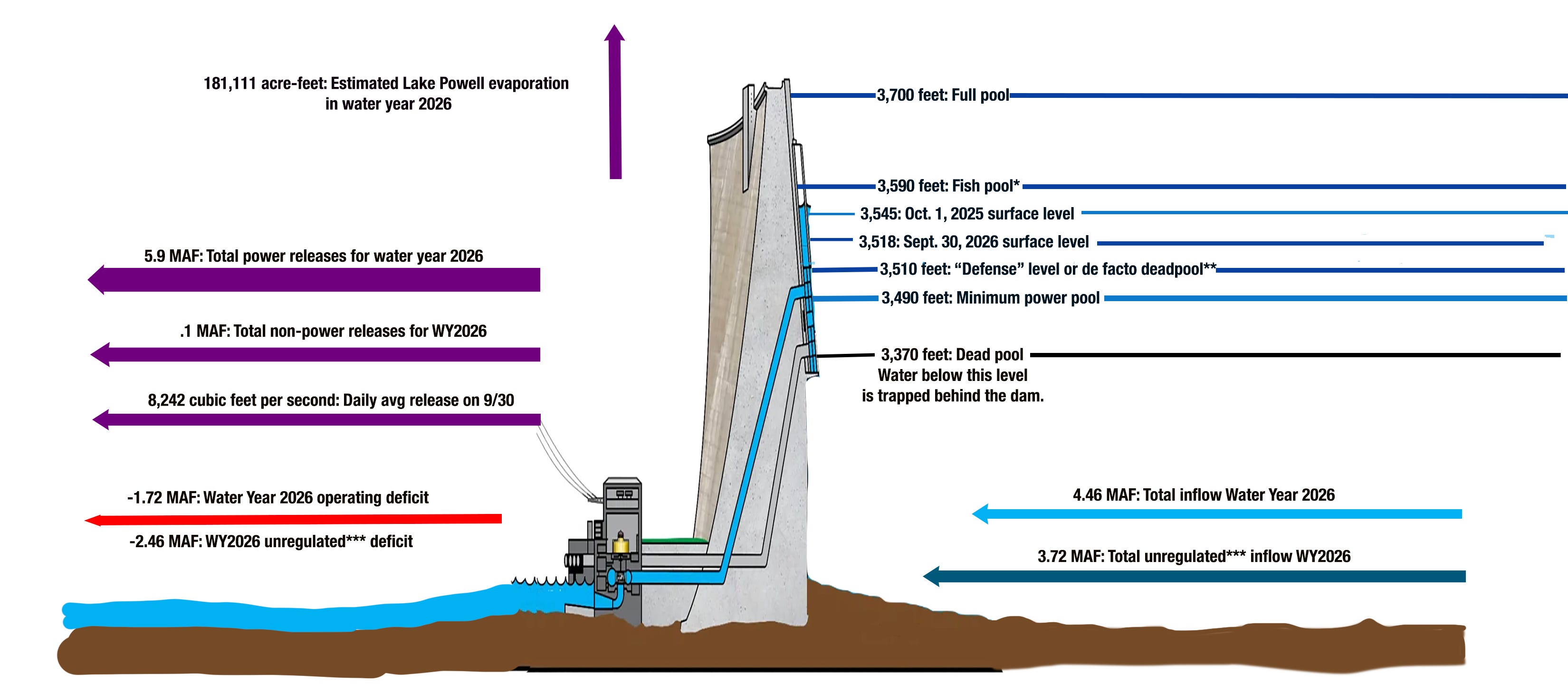
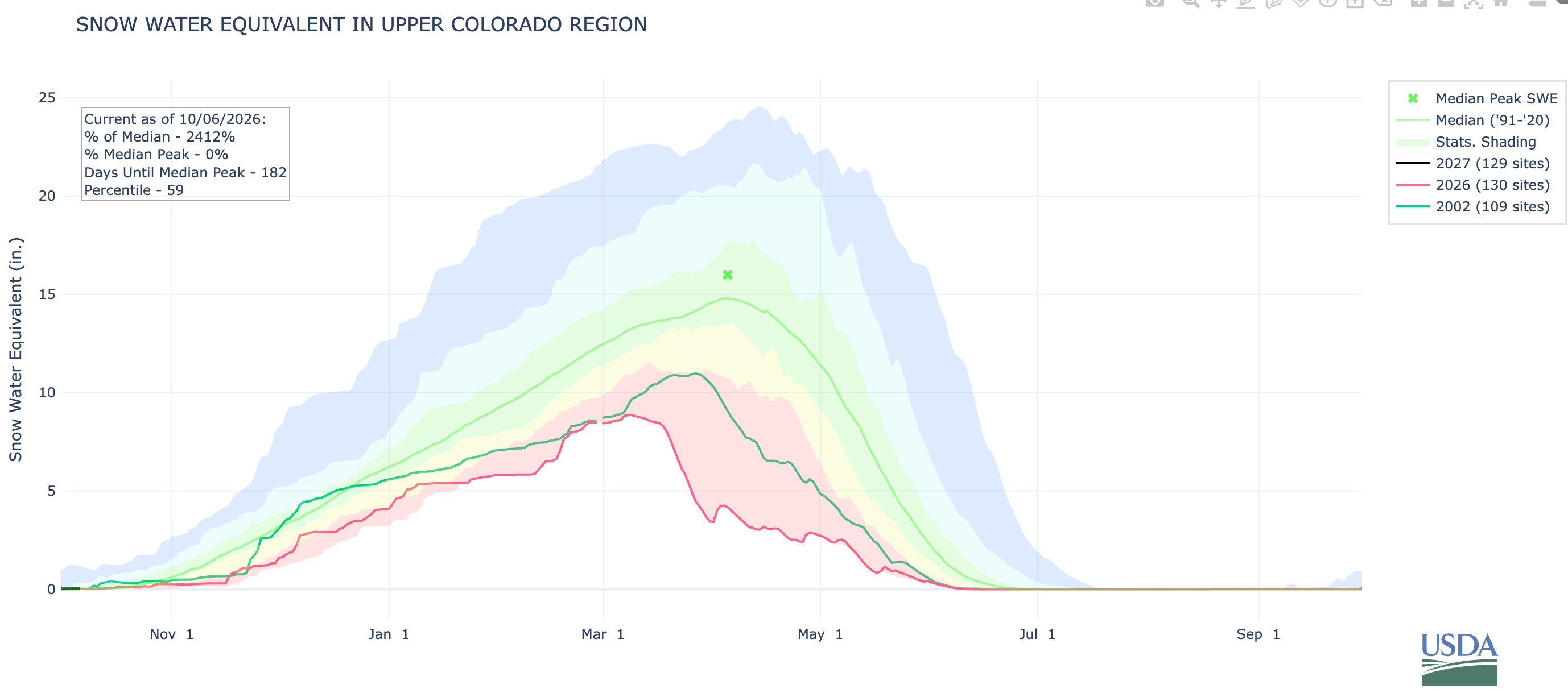
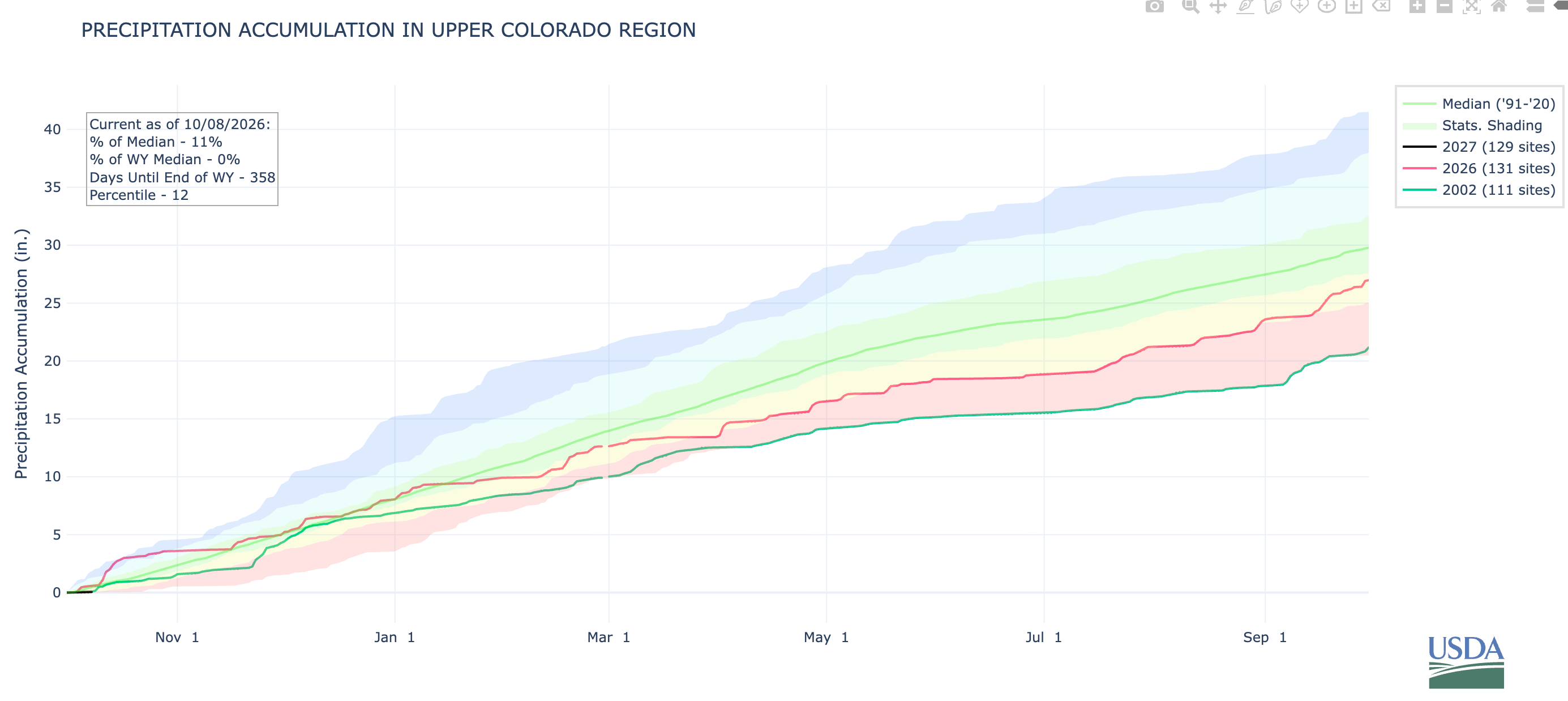
Lake Powell, the nation’s second largest reservoir, serves as a sort of barometer of the Colorado River watershed’s overall health. The reservoir and river have been struggling since the great aridification’s grim onset in 2002. While the river continues to flow, barely, the 2026 Water Year, characterized by one of the worst snow droughts on record, nearly finished off the reservoir. But in the end, it was saved from dropping to “de facto deadpool” by heavy rain at the beginning and end of the water year, and by larger-than-normal releases from upstream reservoirs.
4.46 million acre-feet: Total Lake Powell inflow from the Colorado, Dirty Devil, Escalante, and San Juan rivers in water year 2026. That’s the third lowest on record, behind 2002 and 2021. This is in spite of the fact that the 2026 snowpack was far lower than those two years, and melting mountain snowpack provides about 80% of the river’s water.
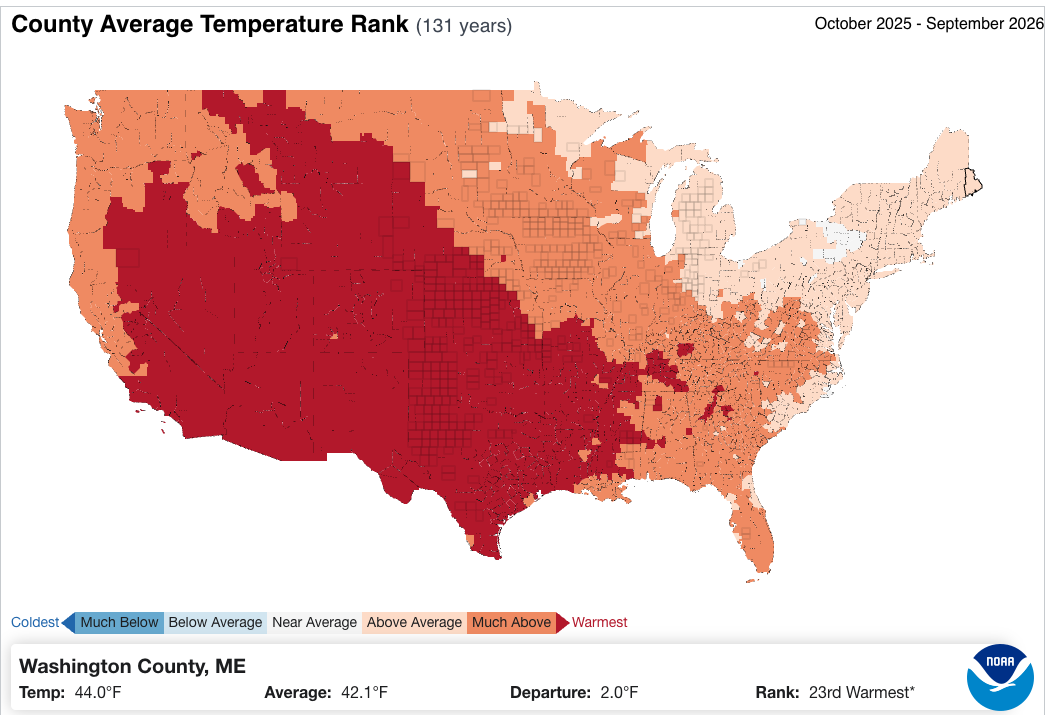
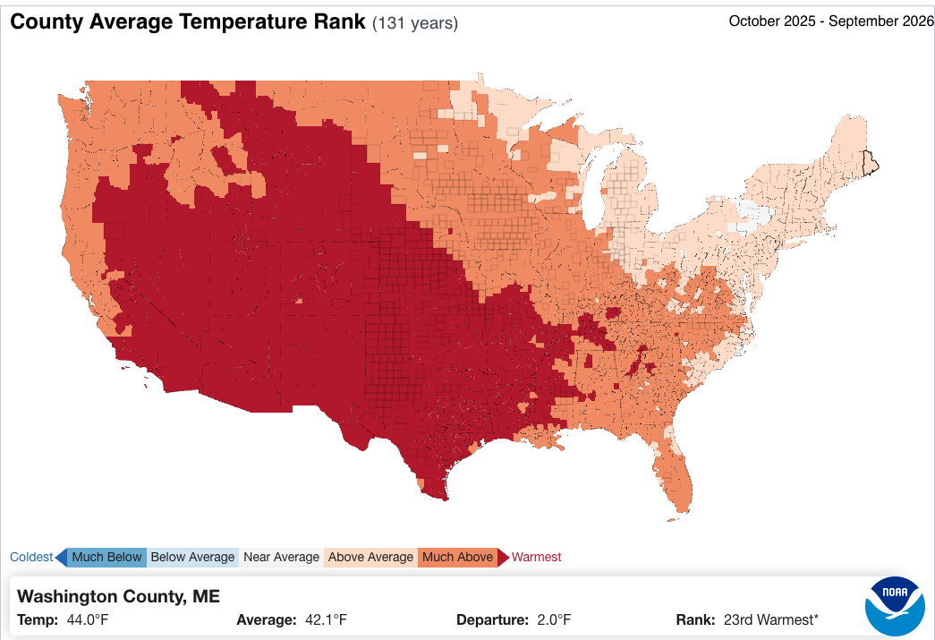
The Colorado River Basin experienced its warmest water year on record (in 131 years) in WY2026.
3.72 million acre-feet. Total Lake Powell unregulated inflow in water year 2026. This is the estimate of how much water would have flowed into the reservoir without any supplementary releases from upstream reservoirs. Which is to say, the feds robbed Flaming Gorge, Navajo, and Blue Mesa of about 750,000 acre-feet to save Powell from shrinking even more. That was bad for those upstream reservoirs and the irrigators, anglers, recreational users, and communities that rely on them, and there’s no way it can be repeated if this winter is below average.
6 million acre-feet: Total releases from Glen Canyon Dam in water year 2026. This is the lowest release since the very early days of the dam (in the 1960s). This means less water in the Grand Canyon and less water flowing into Lake Mead.
181,111 acre-feet: Estimated amount of water that evaporated from Lake Powell in water year 2026. This is equivalent to more than half of Nevada’s total annual allotment from the Colorado River.
1.72 million acre-feet: Lake Powell’s water deficit — or the difference between outflows (incl. evaporation) and inflows — for water year 2026.
27 feet: Amount the surface level of the reservoir fell in water year 2026, putting it within seven feet of the level the federal governnment has chosen to “defend,” meaning they’ll pull out all the stops to keep it from dropping below that (for reasons the Land Desk has gone over many times before). The late September storms brought the level back up a couple of feet.


🛢️ FOSSIL FUEL FOLLIES 📈
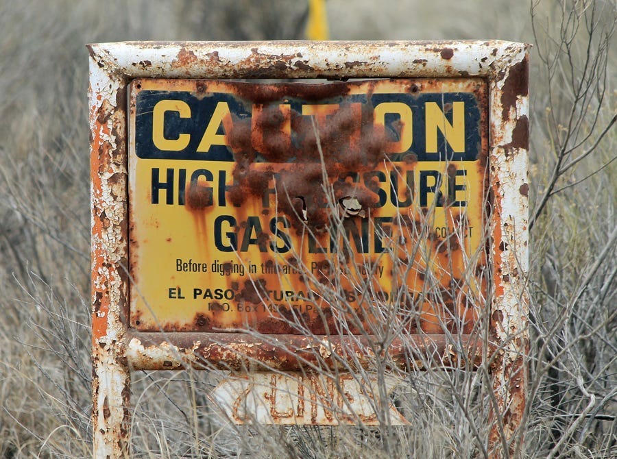
THE NEWS: Not one, but two natural gas pipelines ruptured and erupted in flames at nearly the same time on opposite sides of New Mexico. One was in the Permian Basin in Lea County, where a gas line ruptured and caught fire, killing two people. Details of the incident have not been released, nor have the names of the victims. The other was near La Boca, New Mexico, just south of the Colorado line (and can be seen in the video above). It shot flames high into the sky and ignited a wildfire.
THE CONTEXT: Several years ago, as the oil boom in the Greater Chaco Region in northwestern New Mexico was nearing its peak, I sat down in the sleek, modern headquarters of the Bureau of Land Management’s Farmington field office with two BLM officials to talk about the oil boom. Before we got down to business, one of them asked: “Should we show him the scare map?”
The answer, I guess, was yes, because her colleague handed me the paper showing every well ever drilled in the San Juan Basin, with little red dots for gas, black ones for oil.
It was scary. The northern and central sections of the Basin were almost solid red; in the south and west, dense swarms of black dots strung out along the oil-bearing formations. Dark pinpricks surrounded Chaco Culture National Historical Park. Huerfano Mountain, or Dzil Na’oodilii, where First Woman and First Man and then Changing Woman lived — a sort of Garden of Eden in Navajo cosmology — was embroidered with red and black. The BLM office we sat in, on a fine piece of real estate in the upper-class part of town, has three wells within a quarter mile, and a pumpjack grinds away right next to a golf course green down the road.
To find a stretch of land anywhere in the core of the Basin that hasn’t been drilled or isn’t covered by roads, tanks, pipes or some other hydrocarbon-related infrastructure is nearly impossible — the infrastructure is the landscape. “We’ve got so much pipeline in the ground, it’s like rebar,” said the official, with a tinge of glee. “If you had an earthquake, the ground wouldn’t even shake.”
The official seemed less disturbed than simply fascinated by this fact, and also didn’t seem bothered that he and his colleagues were facilitating even more infrastructure by handing out drilling permits by the dozen and clearing the way for thousands of new wells and all the roads, gathering systems, and pipelines that go with it.
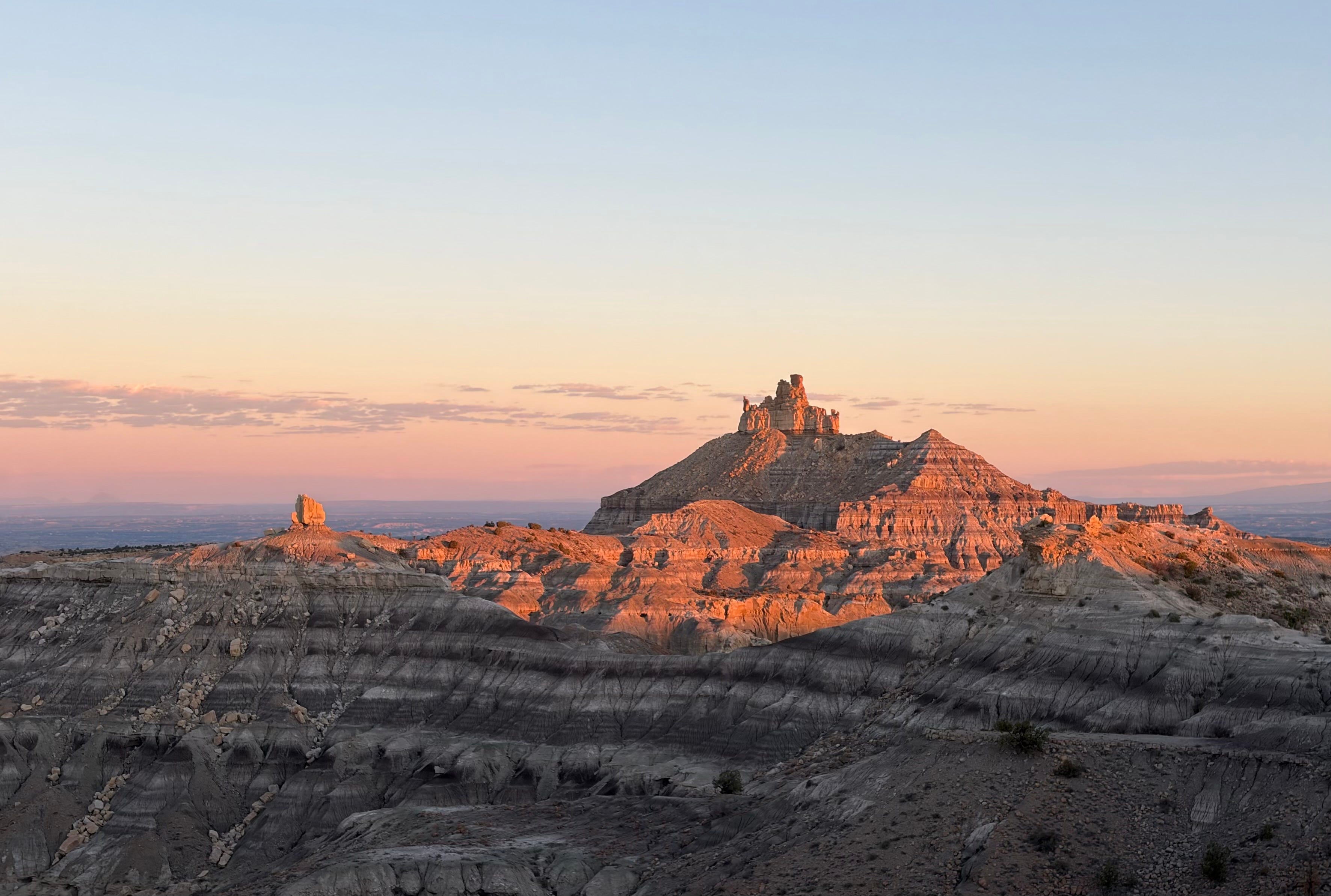
I happen to be writing this at a campsite in the heart of the San Juan Basin gas field. While I can gaze out across the landscape and see nothing but beauty, including the evening’s last light on Dzil Na’oodilii, I am constantly reminded of the ubiquity of the hydrocarbon infrastructure all around me. From just over a little rise comes a slightly squeaky and clanky sound of inadequately lubed bearings, and the low hum and whir of dozens of near and distant pumps and compressors and fans serenades me as I watch the stars unfurl across the big bowl of the sky.
There’s another map of this area that’s even scarier than the one those folks showed me. It includes oil and gas-related “incidents,” which is to say ruptures and spills and explosions and fires and major leaks. Those, too, are all over the map, and happen with disturbing frequency. Usually they’re not as dramatic as the two explosions, but they can be harmful: hundreds of gallons of crude oil sloshed onto the ground and into waterways or aquifers, thousands of cubic feet of methane wafting into the air and adding the potent greenhouse gas to the atmosphere.
When I watch the debate over permitting reform, or read the thoughts of the Abundance crowd, a part of me agrees with the credo of building more. The idea of a new New Deal appeals to me, if done right. Line the highways and interstates with high-voltage transmission lines to carry clean energy across the region, build utility-scale solar on reclaimed coal mines and next to old coal plants and on marginal farmland, build factories to manufacture solar panels and batteries. It would create jobs, revitalize economies, and put more clean energy onto the grid.
Then I hear news about these explosions, look at the oil and gas incident map, and come out here and find that I can’t take a picture of spectacular and sacred landscapes without a tank or well or road or drill pad showing up in it, somewhere. The Abundance folks and the proponents of the permitting reform legislation, or the Bipartisan Affordability and Jobs Act, want to cover the landscape and our communities with even more of this stuff. While many of them support the bill because it would expedite clean energy development, they don’t mind the fact that it would do the same for natural gas and oil and petroleum pipelines. And, in the social media wars raging over this bill, they discount the concerns of environmental groups worry about the cost we pay when blindly adhering to the credo of Build More Stuff.
It makes me want to bring these folks out here to the San Juan Basin and take a little walk across this landscape, which is so suffused with beauty, but also cluttered with the detritus of society’s urge for more, always more.
📸 PARTING SHOT 🎞️
Great reporting! It reminded me of Ed Abbey’s comment about humans’ relationship with planet Earth. He said Earth was much too good for the likes of us.
Thanks as always. Would love an update by you on the whole upper Animas cleanup.