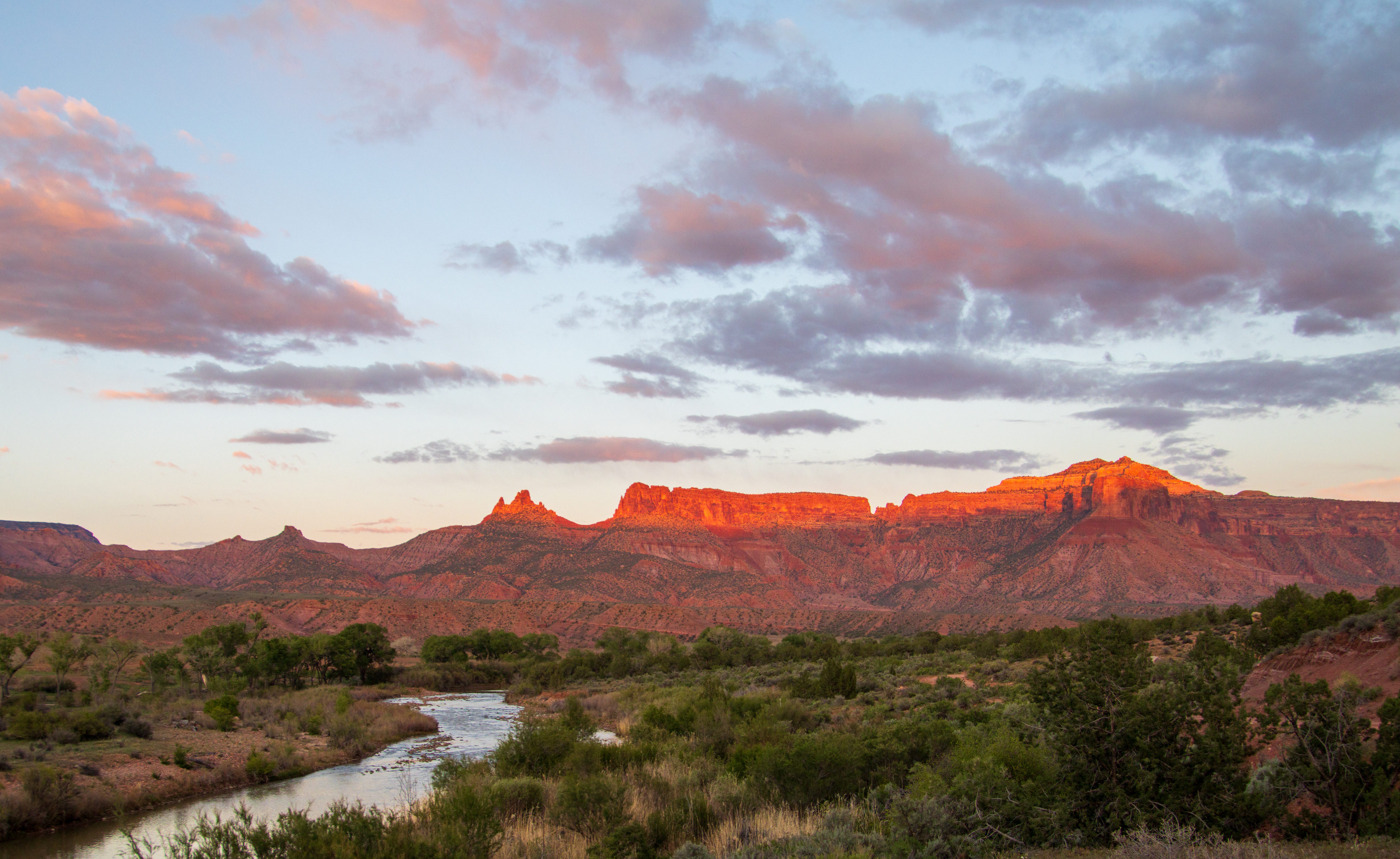
Data centers = heat factories
Dolores River rambling; Forecasters call for sultry summer
đ¤ Data Center Watch đž

Phoenix is hot, thanks to its location and elevation; itâs getting hotter, due to climate change, all that concrete and steel and glass and the urban heat island effect, and heat output from thousands of overworked air conditioning units; and itâs bound to get even hotter thanks to ⌠data centers.
A team of Arizona State University researchers recently published a report on data center waste heat as an âemerging thermal hazard.â What they found will make folks who live near the facilities sweat, literally.
Data centers do a lot of work crunching information to stream movies, power AI queries, make those Tik Tok videos, and keep you doomscrolling, and work creates heat, meaning that data centers need constant cooling. As the paperâs authors put it, âvirtually all electrical energy consumed by information technology equipment is ultimately converted to sensible heat,â and data centers consume huge amounts of electricity. More and more data centers, especially in arid areas, are using air cooling technology, which means taking that heat away from the equipment and putting it elsewhere â i.e. outside the facility, creating thermal plumes.
The researchers determined that these thermal plumes are migrating into adjacent neighborhoods and heating them up, with downwind air temperatures measuring up to .9° C warmer than upwind temperatures. The data centersâ excess heat was detected up to 500 meters, or about 1,600 feet, away from the facility. This is troubling given that many data centers are being constructed in or next to residential neighborhoods. The massive Cyrus One server farm complex in Chandler, Arizona, for example, is about 600 feet from single-family residences.
The authors write:
With hundreds of megawatts of data center capacity currently operational in Phoenix and thousands more proposed, the aggregate thermal impact on the urban atmosphere could be substantial, leading to many pockets of data center heat islands, and potentially having wider-scale implications for the urban climate system.
Keep in mind that this study only looked at the warming effect of on-grid facilities. Many of the new hyperscale data centers in the pipeline are planning to install power generation infrastructure, usually natural gas-fired, on-site, most likely radiating even more heat than the data centers alone. Putting your data center in Wyoming or Alaska rather than Phoenix or Las Vegas is making more and more sense.
âď¸ Wacky Weather WatchâĄď¸
Will it be the Sultry Summer of 2026 for the Four Corners region? The long-range forecasts sure do look that way. The good news is that itâs looking more and more likely that the monsoon will be potent in the Southwest, with the National Weather Service predicting above average precipitation over the next three months. The bad news is they are also calling for higher-than-normal temperatures for the entire West during that time period, which could offset some of the benefits of the rain.
But whether itâs normally hot or abnormally so, the extra moisture will be especially welcome this year. Many an irrigation ditch is likely to go dry in the next month or so, thanks to extra-low streamflows, and regular afternoon downpours could help farmers get their crops to harvest, so long as the storms arenât too severe and donât produce softball-sized hail stones or whatever.
Once the monsoon arrives, it should help dampen wildfire hazard a bit (although the lightning that always comes with it will certainly spark many a blaze). In the meantime, however, big swaths of the West are expected to have above normal wildland fire potential for the next month or so.
And blazes are flaring up here and there, including a small conflagration atop Hermosa Mountain north of Durango that is eerily reminiscent of the 416 Fire in 2018: This winterâs snowpack resembled 2018âs, the 416 broke out on June 1, and the starting points are in the same general area.
The current fire is burning in a hard-to-reach area at higher elevation and was definitely not started by sparks from the railroad. Itâs also growing relatively slowly, having reached just 18 acres as of the evening of June 4.
***
I donât know about yâall, but the crazy winter and spring has screwed up my perception of the water situation. When skiing-obsessed snow-nerd Andy Gleason sent me this photo, I was somewhat surprised to see that there was any snow at all left in the high country, especially enough to carve a few turns on. When I see that the Animas River is running above 800 cfs right now, I think: Thatâs not so bad! And when I see Lake Powellâs surface level inching upwards rather than downwards a temporary feeling of relief washes over me.
Then I remember: Itâs the beginning of June. The north facing high mountains should be coated with several feet of snow, not a few inches. The Animas should be running at 3,000 cfs, at least, and in a good year still would be approaching its peak. And Lake Powellâs inflows should far exceed releases at this time of year, bringing the surface level up by several feet or more, without requiring Flaming Gorge to be drawn down to âdevastatingâ levels.
That bout of summer-like weather at the end of March set my internal season clock a couple of months ahead, so that I expect the conditions to be like they typically would be in late July. So once that split second of disorientation, and accompanying optimism, passes, thereâs a sort of letdown.
Because, yes, the conditions are grim. And it was one of the worst winters, in terms of snowpack, on record. But there are reasons not to despair. While the snow was dismal, precipitation accumulation for the water year so far has been far less so, keeping extreme drought at bay. Temperatures cooled after the March heat spell, a series of storms kept the forests from becoming kindling, and desert rains summoned the wildflowers. Patches of globe mallow, sego lily, primrose, and princeâs plume brightened up the burnished sands of Utah, and my friend and I rode our bikes through a purple-hued super bloom near Farmington.
The land may be dry, but it still offers beauty, solace, and refuge from these trying times.
đ Colorado River Chronicles đ§

Last month I wrote about the despair I felt as I witnessed the virtually dry Dolores River bed a mile or so above its confluence with the San Miguel River. Neither the dryness nor the despair are new, though they both came early this year.
For decades, the wild Dolores would swell up into a raging torrent during the spring runoff. Then, during the summer, Montezuma Valley irrigators would divert nearly all of the streamâs flow, reducing these lower reaches to little more than a trickle come late July and August.
McPhee Dam started holding back those spring flows in the early 1980s. Like any dam, this one robbed so much life from the river. Yet this one also promised to give some life back to the beleaguered river by mitigating the impacts of all of that irrigation. The idea was to capture enough of the runoff to fill up the reservoir in the spring. During summer, the storage could be drawn down to serve irrigators, while most or all of the riverâs natural flow could be sent through the dam to the Lower Dolores. It was like putting the riverâs manic-depressive flows on lithium.
It worked, for a while: The massive spring runoffs, known to hit upwards of 11,000 cfs, were tempered, but enough water still flowed downstream to scour beaches and preserve Snaggletoothâs whitewater snarl. And for the first time in a century the lower Dolores didnât run dry in July. In fact, the year-round flows were enough to build and sustain a cold-water fishery for trout in the first dozen or so miles below the dam and a habitat for native fish below that. Meanwhile, the Dolores River water was able to reach far more irrigators, including the Ute Mountain Ute Tribe and former dryland farmers out Dove Creek way.
It appeared to be a win-win situation. Then, beginning in 2000, things went awry as a long-term drought gripped the region. More often than not, the damâs operators held back almost all of the water running into the reservoir to allow them to continue delivering something to the irrigators. And even then the reservoir still isnât full enough to deliver all of the water thatâs allocated: This year the Ute Mountain Ute Tribe and irrigators outside of the Montezuma Valley Irrigation Company will receive just 13% of their allotted amount. The river below the dam, of course, is the biggest loser, receiving virtually nothing.
And yet, not all is lost. The Dolores River Boating Advocates recently put out a post detailing the grim forecast for this year, but also reporting on a new Colorado Parks and Wildlife effort to help fish in the Lower Dolores: pulse flows. They tested the concept last year by holding water back behind the dam for a few days by reducing release flows to 24 cfs, then bumping up releases to 75 cfs create a slight surge of water to reconnect downstream pools, to induce enough current to keep the water cooler, and allow fish to move around again.

The Boating Advocates write:
While CPWâs new management concept wonât put more water in the river, it does try something new. This strategy begins to recognize that the ecological integrity of river ecosystems depends on their natural dynamic character. Just as the human heartbeat vacillates to stay alive, streams and rivers require variability to function well.
Of course streams also need water, and itâs so scarce this year that the base flows will be just 5 cfs, or one-fifth of last yearâs base flows. And so the sorrows continue for the poor Dolores River.
Our River of Sorrow
On the morning of May 29, 1998, three friends of mine launched a canoe, a kayak, and a raft from the Bradfield Ranch put in along the Dolores River below McPhee Dam on a three day tour. I, the only non-pro boater in the group, tagged along for the ride. The trip would turn out to be fairly typical for the lower Dolores, which is to say it was incredibleâŚ


