The following is an excerpt from Sagebrush Empire. I figured with the San Juan River at Bluff clocking out at 7,120 cfs, this was as good a time as any to run this piece.
“We’re geniuses!” bellowed Gabe, as we embarked on a rafting tour of the San Juan River in March 2013. The mercury was pushing 80 under a cloudless sky, only a slight breeze blew upriver, and the water was unusually clear. The ranger had just told us we’d have the place pretty much to ourselves: several other parties had cancelled due to low water and a storm forecast for the middle of the week. We, however, knew better. Weather forecasts more than 24 hours out are almost always wrong, and the stream gauge was probably broken. There would be plenty of current to carry us along on a seven-day tour of sandy beach camps and Edenesque side canyons. Geniuses, indeed.
That was Saturday. By Monday, our confidence in our cleverness had waned and serious questions concerning our collective intelligence and mental health—most notably from Gabe’s six-year-old son, Jack—were gaining strength among the mini-flotilla as it was battered by dust storms, snow, bitter cold, low water, and a Lord of the Flies-like ratio of seven children to four adults.
The San Juan River is tempestuous, silty, shallow, polluted, and teeming with weird fish. It’s also a lovely body of water. The Diné call it Sa Bitooh (Old Age River), Tooh Bika’i, (Male Water), Bits’iis Nineezi (One with Long Body), Bits’iis Nteeli (One with Wide Body), and Nooda i Bito (Utes’ River). The Utes, who followed the seasonal rounds throughout the San Juan watershed, call it, among other things, River Flowing from the Sunrise, since it runs east to west for most of its length. Spanish explorers called it Rio de Nabajoo before rechristening it after Jesus’s favorite disciple. It is the carotid artery of the Four Corners country, draining a good portion of the San Juan Mountains and the South San Juans, and is therefore an indicator of the region’s health. Its tributaries include the Navajo, Blanco, Piedra, Los Pinos, Animas, La Plata, Mancos, and Chaco Rivers, along with hundreds of intermittent streams, each of which become raging rivers after a thunderburst. If the snowpack is scant in the mountains, then the San Juan’s flows will be weak, and vice versa. If mines are blowing out or draining heavy metals and acidic soup into mountain streams, then those pollutants will eventually wind up in the San Juan. The river is a shapeshifter, shallow and languid and warm at one moment, raging and violent the next. After one particularly big winter and the ensuing spring runoff, Albert R. Lyman wrote, “the old river seemed bent on retaking every acre of its ancient dominion.”
In the 1880s, the “Bluff Excitement” erupted when someone decided that the tiny gold flakes that had been carried down from the high mountains and deposited in the silt on the San Juan River bed could be extracted and marketed. Thousands of men, and a few women, too, descended on the river and Bluff, bringing their greed, whiskey, and Gentile ways with them. Like most gold rushes, this one was spurred on by hyperbolic newspaper reports, which in turn were fueled by those who stood to benefit from a mass movement of people, namely the railroads, merchants, and stage lines.
Fortunately for the day’s Bluffites, most of these morally bankrupt souls wouldn’t linger. The prospectors found what they were looking for, sure, but it was primarily in the form of “flour gold,” tiny particles mixed with thick silt. While the metals could be recovered, the process was costly and time-consuming. Promises of easy money were blown. By mid-January 1893, the same newspapers that had fed the boom were declaring the whole thing a fraud, a “Fractured Boom,” and “The San Juan Fake.”
The handful of hangers-on who remained continued hauling themselves from Bluff and even Farmington to their downstream prospects via boat. Bert Loper, who would later become known as a whitewater river-running pioneer on the Colorado River, got his boating start looking for San Juan gold.
The gold-diggers would come and go. The river, however, wasn’t going anywhere, and it would prove to be a far greater obstacle to the Mormon settlers. The San Juan near Bluff certainly looks friendly, particularly on a hot early summer’s day before the monsoon arrives: the current is slow, the water warm and silty and shallow enough that it can be crossed on foot in places. It—and the warm climate and sandy soils along its banks—seem tailor-made for irrigated farmland. And so, shortly after they arrived, the Hole-in-the-Rock folks started building canals, ditches, and diversion dams to tame and harness and put the river to good use. But all it took was one good rain way up in the mountains to bring water levels up and wreck all the fruits of their hard work. The river’s anger culminated in 1911, when eight inches of rain fell on the high San Juans and elsewhere in the region, causing the San Juan River to swell up to 150,000 cubic feet per second—which is more than ten times the typical volume of the Colorado River in the Grand Canyon—as it literally ran through the streets and houses of Bluff. The raging river inundated and ate away a good portion of the tiny city and ripped out the brand-new bridge at Mexican Hat, which, when it was built, stood thirty-nine feet above the river.
Water scarcity was just as likely as overabundance, and in the 1890s a region-wide drought so reduced the flow of the San Juan that, according to Lyman, “small pools were writhing with dying fish, and hunting them out of the larger ponds became a winning sport. Navajos offered them for sale by the sackful. In fact they learned, contrary to their old traditions, that fish are good to eat.”
By the 1930s the population at Bluff had dwindled so that a traveler called it a “ghost city.” The arduous and sometimes terrible journey across the desert may not have diminished the Hole-in-the-Rockers, but Old Man River sure as hell did.
When Gabe, Hilary, Jess, and I, along with four kids under the age of six and three teenagers, got on the river, and when we deemed ourselves geniuses, the San Juan was running at just 550 cubic feet per second, about one-fourth the median flow for that time of year. It was hard to imagine such a meagre stream wreaking havoc, perhaps because the river has been greatly diminished since those more tempestuous days.
As populations upstream along the San Juan and its tributaries grew, more demands were put on the water in those tributaries. Irrigators inundated fields with no thought for efficiency. Towns sucked up water for drinking and flushing and lawn watering. Mills and smelters used creek and river water for processing the metals. In 1962 the federal Bureau of Reclamation dedicated Navajo Dam about 120 miles upstream from Bluff, which backed up the San Juan and Los Pinos Rivers, inundating the heart of Dinétah as well as the towns of Arboles and Rosa and clearing the way for the Navajo Agricultural Products Industry, or NAPI, a vast expanse of fields on the edge of the Navajo Nation irrigated with San Juan River water. The Four Corners Power Plant and San Juan Generating Station began pulling billions of gallons of water from the river for use in steam generation, cooling, and cleaning. In 1976 the San Juan-Chama Project began diverting as many as 35 billion gallons of water per year from the Navajo River, a San Juan tributary, to the Chama River for use by Albuquerque and others along the Rio Grande.
Combine all that with prolonged drought—most scientists prefer the term aridification, since it appears to be permanent—and anthropogenic global warming, and you have all the ingredients for an ailing stream. Records from the US Geological Survey show a clear decline in flows over the last century. The river is flooding less frequently and with less severity and low flows are getting lower. In other words, the San Juan River is shrinking.
For me, the low water that year was a double-edged sword. On the one hand, it would mean that our rafts would move more slowly down the river, which would make our somewhat ambitious goal more difficult to achieve: doing both the upper and lower sections of the San Juan in a week’s time. On the other hand, big water scares me, and 550 cfs is not big water.
It’s not that I don’t like water, it’s just that I find its power intimidating and I tend to simply sink when I try to swim. I’ve long tried to justify and explain away my issues with water: I’m a desert guy, a Colorado guy, and a Virgo, which, they tell me, is an earth sign. In any event, for this reason, combined with my phobia for gear, I came to river rafting a little later than many of my Durango peers. I had rafted and tubed and even “logged” down the Animas River a number of times, but never went on a real rafting trip until I was in college in Santa Fe, and some friends of ours told us they were running Westwater, on the Colorado River, and we should join them.
My car was out of commission so we decided to take Gabe’s tiny 1975 Fiat. We picked up a raft in Durango and lashed it to the top of the car and headed into Utah, , stopping only at the state liquor store in Moab to get a jug of Ernest & Julio Gallo Burgundy. We were supposed to meet up with friends, but nobody even knew what a cell phone was back then and a “mobile” phone was something that only TV millionaires had in the back seat of their limos, so we just parked between the road and the railroad tracks near the put-in and cooked up some spaghetti and drank the Burgundy and waited until they showed up and nearly jumped out of our skins when the Amtrak shot by doing 80, a streak of lights and bored faces pondering the darkness outside. Somehow we found our friends and went to their camp near the river under towering cottonwoods and drank far too much and I woke up in a bed of desiccated cow crap with a pounding headache and a mud-drool crust on my chin. We loaded up Gabe’s old raft with no fewer than 12 people and set embarked, the weighted-down craft riding alarmingly low on the smooth, glassy water. Only then did Gabe tell me about Skull Rapid and the Room of Doom and how people sometimes needed to be airlifted out of the latter, assuming it didn’t kill them. Then we realized we didn’t have a bail bucket.
A few years later, after I had graduated from college and was drifting aimlessly, my friend Chris rousted me from my job at the seed factory and my solitary Santa Fe life and talked me into going on a weeks-long rock climbing trip across the Western United States. I’m not much of a rock climber, but I guess Chris couldn’t get anyone else to go with him, so there we were, driving toward the Wyoming outback in his battered, blue Subaru. Before we left, Gabe, who was living in Salida at the time, called and told me he had something important to tell me and it had to be done in person. I figured he and his girlfriend were getting married, or maybe were having a kid, or Gabe had decided to abandon his Marxist ways and become a hedge fund manager. He met us at Turkey Rock, a climbing area on Colorado’s Front Range, and dropped the bomb: “We’ve got a permit for the Grand and have a couple of extra slots. We want you to come.”
Getting invited on a private Grand trip is like getting a table at Balthazar, or whatever that place is, or getting your fiction piece in the New Yorker. Seriously. They were giving me the opportunity to spend three weeks with 20 other handpicked people in one of the most spectacular places in the world. I was unemployed, single, and, when not vagabonding across the West with sore arms, chalky fingers, and scabbed knuckles, I lived out of my 1973 Toyota Corolla under a giant ponderosa tree in Chris and Margery’s front yard. That may sound a bit glamorous these days, when everyone’s living the Instagram-ready #vanlife. Let’s just say it’s best that digital cameras didn’t yet exist.
A couple months later I showed up at Gabe’s place in Salida equipped as if going on a week-long backpacking trip only to find everyone else loading up guitars, volleyball nets, horseshoes, Halloween costumes, and a crapload of food and booze. It was only then that I learned that a raft is like an inflatable pickup truck, only one that can carry a lot more stuff. My sparse gear—literally everything I took fit into one leaky dry bag—was a source of constant ridicule, as was my abundance of fear.
I will refrain from going into detail about the trip, lest I destroy the reputation of otherwise perfectly respectable human beings who are now business owners, mayors, land-use planners, and teachers. Suffice it to say that it was an unforgettable experience and that the Grand Canyon is a natural wonder beyond compare. And, yes, I was scared. The fear comes on slowly, a tingly feeling in the gut when you first catch a whisper of the sound of the rapids. The whisper rises to the sound of a jet plane flying far overhead, and then to a low roar. Your heart rate speeds up, maybe even flutters wildly—I should probably get that checked out—your bowels loosen and threaten to evacuate themselves, and you and Sarah, your boat-woman, start singing Neil Diamond songs at the top of your lungs in hopes of drowning out the growing anxiety of what’s to come: Crystal, Lava Falls, Grapevine, Hermit, the ginormous rapids that can suck in a much bigger raft than ours, chew it up, and spit it out, broken and in disarray.
After three weeks we emerged and unrigged the boats and loaded them up and headed back towards home. As we drove up the long dirt road to the interstate, I was overcome by anxiety, just as when we approached a rapid, only this time it wasn’t balanced out by even an inkling of sweet anticipation, and no matter how many stupid jokes I might make or how loudly I might sing cheesy seventies songs, I couldn’t drown out the building roar of angst at the realization that the “real” world, the outside world, still existed and that I would have to return to it, and play some sort of role in it, and I had no job, no girlfriend, no money—I had to borrow cash for dinner because I had maxed out my credit card buying cases of Hamm’s Ice for the trip—and no real prospects at all.
That sinking feeling didn’t go away for quite a while, and the feeling that the “real world” is cruel and scary has never really left me. Still, if anyone invites you on a Grand trip, say yes, unequivocally yes. If Gabe invites you on a San Juan trip in March during near-record-low flows and when a storm is approaching, you’d be forgiven for saying no.
When it comes to boating, the San Juan River in Utah has two main sections, the Upper and the Lower. Boaters doing the Upper put in at Sand Island, just below Bluff, and meander down past Comb Ridge and through the Raplee Anticline before taking out at Mexican Hat. With a good current or a strong rower, the Upper can be done in a day, most people take three days, and I once was on a quite leisurely five-day Upper trip.
The Lower section starts at Mexican Hat, where the Upper section ends. From there, boaters float under the iconic Mexican Hat Bridge before descending into the deep and curvy gorge of the Goosenecks on their way to Clay Hills Crossing, nearly 60 miles downstream. Most boaters take four to five days to complete this stretch, which is accessible from off-river in only a few places, and those access points require big hikes and, in some cases, perilous climbs down sketchy cliffs. I know this because I’ve made those same climbs on more than one occasion to join up with already in-progress rafting parties.
So, even though the water was low, and we were trying to cover too many river miles in too short of a time span, I was pretty damned psyched to finally do the Lower from top to bottom and not have to hike across the desert to do so. I was legitimate at last, and by then had enough multiday raft trips under my belt not only to know how to pack for it, but also to be able to pilot a raft in a vaguely competent manner. I had a good job, a lovely wife, two wonderful kids, and plenty of room left on multiple credit cards. I felt as if, having finally reached middle age, I deserved to take it a bit easy for once and go camping in the desert without subjecting myself to all kinds of adversity. I even had a tent.
Not that the trip would be easy. Rafting trips never are. When you get to camp you have to de-rig, set up camp, cook dinner, wash dishes, and then in the morning you have to cook breakfast, wash dishes, break camp, rig the boats, and row for hours on end. Backpacking requires far less labor, it turns out. But then, there aren’t Dutch oven enchiladas or an endless supply of cold beer when you’re backpacking, either. So it all works out in the end. The first couple of days on our trip worked out well, too. The sun shone, the breeze was warm, the sky was blue. We checked out a Chacoan great house above what William Henry Jackson, when he came through the area in 1878, called Epsom Creek because its waters taste like Epsom salts. “For a distance of some 25 miles above its mouth the valley of this creek presents upon its eastern side a remarkable wall, some 400 feet in height, insurmountable throughout its whole length, with the exception of one place, where the Indians have made a way for themselves,” he wrote, referring to Comb Ridge, the Spine of the World. From just beyond that point onward, wrote Jackson, the river “is then lost to all knowledge until it reappears mingling its waters with those of the still more turbid Colorado.” It so happens that in 1916 surveyors suggested building a dam 264 feet high at this same spot, where the river goes into the Raplee Anticline, which would have inundated Chinle Wash, Comb Wash, and the town of Bluff.
We woke on day three, Monday morning, to a sepia-toned sky. It was beautiful and eerie and a little mysterious in that we couldn’t really understand what kind of natural phenomenon we were witnessing. It vaguely resembled that orange-red cloud-glow that sometimes saturates the sky at morning, but only vaguely, since there didn’t seem to be any clouds in the sky. As we ate breakfast, preparing ourselves for a big day, a breeze kicked up. It wasn’t much, but by the time we broke camp it was strong enough to cause the nylon of the tents to flap loudly. Gabe seemed a little concerned as we rigged the boats. I didn’t realize why until I cast off and started rowing—into a stiff headwind. A raft isn’t exactly an aerodynamic craft, and rowing a heavy one against the wind is difficult. Rowing one against the wind when the current is virtually nonexistent can be Sisyphean, with any forward progress gained offset and then some when one pauses to take a breather.
We had three boats. Gabe and Hilary traded off at the oars of one, and their two young children were with them. Jess piloted another, a heavy beast of a craft that leaked air, with her two kids. And I rowed the third—a borrowed raft, meaning for the first time in my life I had perfectly adequate gear—with three passengers: my two teenaged daughters and one of their friends, who had just arrived from Germany for a three-month stay in Durango. It took us all morning to get just seven miles downstream, to a place where the river bends back into the base of Raplee Ridge before turning again for the final stretch before Mexican Hat. As we rounded the bend, the wind picked up even more, forming white caps on the otherwise smooth river’s surface. Clouds moved in overhead, kids hunkered down between dry bags, even though it meant kneeling or lying on the damp boat floor. One of our chairs broke free of its strap and sailed, airborne, upstream. It might have been an aesthetically pleasing vision had it not meant that I would be sitting my middle-aged ass on the ground for the rest of the trip. I rowed frantically upstream to retrieve it, which turned out to be far easier than rowing back downstream to make up lost ground.
The final mile to the Mexican Hat put-in and takeout, where we had decided to stop for lunch, was the longest mile I had ever known. Our arrival there was not exactly reassuring, though. Normally at that time of year, spring break for Durango’s schools, the put-in area would have been crowded with parties getting on and off the river. On that day it was empty, a sign as ominous as that morning’s eerie sky. This time Gabe didn’t crow about having the river to ourselves but instead walked around erratically in the way he tends to do when he’s nervous or is trying to think. While the kids were secured at the shade structures, we adults did our best to prepare lunch, and as we were rooting around among our boats for the ingredients, the steady wind gusted, and Jess, who was standing somewhat precariously on her boat at the time, was lifted up into the air and slammed back down on the boat, her knee coming down hard and painfully.
As we ate our sandwiches, sand crunching in our teeth, Jess’s knee swelling, we actually considered throwing in the towel, hitching a ride back to our cars, and bailing altogether. I think if we were slightly smarter, slightly less stubborn, slightly less proud, we would have done just that and headed home like all the other people who had been lucky enough to get permits but had chosen not to use them. Instead we all looked at one another as if the idea of using common sense was the craziest thing we’d ever heard of. Besides, we only had fifty-seven miles to go.
That morning’s mystery of the sepia sky wasn’t a mystery for long. The phenomenon was caused by the same thing that was grinding our teeth down as we ate our sandwiches: dust. All across the Colorado Plateau, strong easterly winds were picking up sand and dirt, lifting them high up into the air, and carrying them across the sky into Colorado, where the dust particles would mingle with snowflakes, or perhaps even serve as the particles around which the snowflakes formed, and fall back to the earth. In the San Juan Mountains, the dust that was blowing past and above us would end up as a reddish-orange film on top of the vast fields of snow, giving them a rose-colored hue.
Dust storm feels too dramatic a phrase to describe the phenomenon. The incidents in the Four Corners country usually don’t involve a wall of airborne sand, thousands of feet tall, rushing across the desert and gobbling up everything in its path, as sometimes happens further south in the Phoenix area. Dust event, on the other hand, feels too clinical. I prefer aeolian—or windborne—dust cloud, since its root is the Ancient Greek god of wind, Aeolus. These episodes are not uncommon in these parts, happening several times a year, most often in late winter and early spring. “Our party experienced a violent windstorm when we were several miles above the mouth of Piute Creek,” wrote Hugh D. Miser in a 1924 report on a trip down the San Juan River on sixteen-foot boats. “It blew in gusts and picked up sand and fine yellow dust, which were carried up into the air for hundreds if not thousands of feet.”
The episode in which our little flotilla was involved, however, was a doozy among a series of dust doozies. The Silverton-based Center for Snow and Avalanche Studies was recording and analyzing every dust event at its Senator Beck Basin study plot near the top of Red Mountain Pass. According to the center’s data, our dust event was the, well, dustiest in at least four years. In Durango the dust was so thick that it fell with rain as a gritty red slime, coating cars and buildings and just about everything else; the Durango Herald ran a woe-filled article about a window washer whose work was destroyed by the storm, forcing him to start all over again. Another dust event a week later would whip up a nasty wildfire near Farmington and contribute to a fatal car crash.
Meanwhile, in the mountains, all that dust brings about subtle but significant changes by throwing the snowpack’s albedo—or ability to reflect the sun’s rays—out of whack. When dark-colored dust (or ash, or carbon, or what have you) coats the snow, it reduces the albedo, causing the snow surface to absorb more solar energy, thereby melting the snow more quickly.
Dust on snow speeds up the snowmelt, disrupting alpine flora phenology and pushing the spring runoff earlier into the year. Reduced albedo enhances evapotranspiration and snow sublimation, thereby reducing the amount of water that goes into the streams and rivers. Aeolian dust on the snow, alone, has pushed the peak of spring runoff of the Colorado River watershed up by three weeks, when compared to the period prior to the 1850s, and it has also reduced the total runoff volume.
These aeolian dust events are natural and have probably been taking place every spring since the end of the Pleistocene era and the retreat, some 12,000 years ago, of the glaciers that carved many of the region’s valleys. Maybe the dust events occurred during the last ice age and contributed to the melting of the glaciers, which was mainly caused by global warming resulting from a buildup of carbon dioxide in the atmosphere. That, too, was natural. But just as human activity is again causing an increase in carbon and a warming climate, so, too, has human activity exacerbated the aeolian dust cloud phenomenon.
By examining the sediment that had built up over nearly six millennia at the bottom of alpine lakes in the San Juan Mountains, researchers in 2008 concluded that most, if not all, of the dust deposited on the San Juan Mountain snows is from the Colorado Plateau, not Asia or other distant lands, as has been hypothesized in the past. And they found that dust events have been occurring for thousands of years but picked up significantly beginning about a century and a half ago, coinciding with the white settler-colonist influx of the mid-1800s and peaking in the early part of the twentieth century, when volumes of dust were five times higher than they were prior to colonization. The timing leaves little doubt regarding the cause of the uptick in dust: a combination of the newcomers’ land-disturbing ways, which include mining, development, tilling for farming, logging, and, perhaps most dust-raising of all, cattle grazing, which probably did as much to alter the landscape of San Juan County as anything else wrought by humanity thus far.
The cattle and sheep ate the native grasses and trampled the fragile soil, making way for non-native grasses to invade and preclude the return of the native vegetation, while also encouraging gulley-forming erosion. Cattle hooves will also wreck the fragile cryptobiotic crust that is critical to the desert ecosystem, and which, as renowned cryptobiotic crust researcher Jayne Belnap put it, holds “the place in place.” Cryptobiotic crust, sometimes known as cryptogamic soil, is ubiquitous, or once was, in most of southeastern Utah. At first glance it looks just like, well, dirt, only with a dark-brown hue that resembles desert varnish. Bend down and look more closely, however, and you’ll see a miniature, living world—a symbiotic mingling of cyanobacteria, lichen, and mosses—which is particularly noticeable when the crust is wet. The cyanobacteria are made up of filaments wrapped in sheaths. And when the crust is destroyed, it leaves those same soils vulnerable to erosion and to the types of winds that were blowing our rafts upstream.
And the damage is, indeed, irreparable. Once wrecked, cryptobiotic crust may take decades, even centuries, to fully recover. In 2005 Belnap published a paper on the impacts of decades of grazing on soils in southeastern Utah. She and her co-researcher ventured into the Needles District of Canyonlands National Park and compared an area that had been grazed from the 1880s until 1974 with Virginia Park, an area where an impassible cliff kept cattle at bay, and which is now a “relict area” shut off to people entirely, save for researchers with a light touch. Belnap’s findings are disturbing. Even thirty years after the cattle had been removed from the historically grazed site, the land had not recovered.
Clearly cattle are not the only culprit. ATVs, mountain bikes, cars, and bulldozers can wreck cryptobiotic crust and mobilize dust. Chaining huge swaths of juniper forest to make way for forage or even sagebrush is hugely destructive and dusty. Before each of the hundreds of oil and gas wells were drilled in San Juan County, more than an acre of land was scraped clean of all vegetation, top soil, cacti, sagebrush, and even centuries-old juniper trees. Every new house or hotel built on Moab’s fringe stirs up dust. Springtime tilling of corn, bean, sunflower, and alfalfa fields kick up huge amounts of dust. Even a single human backpacker trodding through the P-J forest in hiking boots can crush and break up the living soil. All of these activities contribute. But cattle are special due to sheer numbers—some two million cattle graze on BLM lands each year—their proclivity for finding every blade of edible grass in every nook and cranny, and their insatiable appetites.
As we sat and ate our sand sandwiches, we were right in the thick of this big cycle of soil disturbance, aeolian dust events, reduced albedo, faster-melting snow, diminished river flows. We were literally eating the dust at the same time as we grappled with its ultimate effect, a low river and a current that couldn’t compete with the wind. It was a strange sensation and somewhat revelatory in that we were experiencing the interconnectedness of the region, the intimate link between desert and mountains, in real time.
We didn’t decide to continue downriver. But we also didn’t decide to bail and go home, so the default position was to get back on our rafts and continue onward into the wind and into the deep and kinky gorge known as the Goosenecks, thus following in the wake of E. L. Goodridge, who in 1882 piloted a wooden boat from Durango all the way to Lee’s Ferry on the Colorado River in search of gold, oil, or other mineral wealth. In spite of the difficulty it felt good to be back at the oars where one has to think about one thing and one thing only: pulling oneself, the raft, and everything on it downstream as expediently and efficiently as possible. We drifted below the village of Mexican Hat then under the iconic bridge that spans the river. I spun the boat around so that I was facing upstream, both to get more power out of the oars and to enjoy the view as we floated past the point of no return.
Just then the wind kicked up. In reaction, I pulled hard on the oars, once, twice, managing to keep the forward momentum going, but also veering sharply to river right even as the river curved to the left. When I hit the cliff I felt it first as a light bump against the raft and then as a crunching yank of the oar out of my hand as it got squeezed between boat and bank. As I tried to comprehend what was happening I stopped rowing and the wind gusted, carrying me at least fifty yards upstream in a matter of seconds. My daughter was so hunkered down that she didn’t even notice.
Just as I regained my composure and looked back to see the other boats way ahead of me, the ice started falling from the sky. Not ice, really, but miniature snowballs called graupel, which aren’t quite as vicious as hail, but still sort of sting when they hit bare skin. The graupel soon transformed into schneeregen, another German term that literally means snow-rain, because it’s not quite snow and it’s not quite rain. The flakes were huge, cold, and soaked me through immediately. I couldn’t stop paddling to put on any rain gear, lest I lose the precious progress I had made.
Relief came over me when I saw that the other boats had pulled over and the passengers were huddled in an overhang, sheltered from the menace thrown at us by the weather gods. Gabe had already lit a fire by the time I stuffed myself into the overhang. It helped thaw my hands, which were numb with the cold. I remembered then a time when I was about the age of Gabe’s son, and my mom and dad and brother and I were camping at the mouth of Mule Canyon in Comb Wash. It was March, spring break, and I awoke one morning with a terrible sore throat.
I suppose some parents might have packed up, headed home, and taken me to a doctor at that point, but not mine. To be fair, I had sore throats, colds, and other minor respiratory sicknesses quite often, and they never turned out to be serious, so it probably did seem like overkill to end the whole camping trip just because of that. But to be fair to me, the root cause of my ailments may very well have been the incessant inhalation of the secondhand smoke that emanated from my parents at nearly every waking moment.
So we set out on a hike on that March day long ago, and a couple hours in the sky grew heavy and thick, wet flakes started to fall. I imagine I started to cry at the same time. My dad guided us to an overhang, not unlike the one that our rafting party had taken shelter under, and built a little fire. He took an empty generic orange pop can and poured water into it and tossed a bunch of Mormon tea branches in there and then set it on the fire. It tasted like hell, but the warm tea soothed my throat and made my eyeballs buzz a little bit, and we eventually made it back to camp without dying.
I started to tell the story to my overhang companions, but they clearly weren’t up for one of my stupid stories, so I stopped. The mood under the overhang felt somber. It would have been one thing had we been out on a day hike and gotten caught in a storm and just had to wait it out before running home, but this was different.
“Uh, how far did you say we had to go still?” I asked, trying to make conversation.
Gabe looked at me and muttered, along with a sigh, “Fifty-seven miles.”
At that, everyone fell silent, the only sound that of incessant dripping all around, and me doing some emotional-support snacking on a bag of peanut M&Ms that I wasn’t supposed to be eating in front of the kids.
I turned to offer one to Gabe’s son, only to find him gazing out into the falling snow, as if the truth were written on the cruel and angry sky. Then he spoke that which he had discerned: “You are not a genius, Dad.”
We waited a long time in that overhang, and when the snow finally let up somewhat, we reluctantly boarded our boats and continued downstream. The wind was just the front part of the storm, it turns out, so it relented, making progress easier if not warmer. Not that our troubles were over. That night when we arrived to the planned camp, a nice sandy beach with willows that offered shelter and shade, it had been destroyed by what I can only describe as a mini-glacial event. Apparently the river had frozen upstream a month or so earlier, creating a sort of ice dam, which then broke free and crept downriver bulldozing everything along the banks, including campsites, leaving big piles of debris and precious few tent sites for rafters. I sent my kids to go set up a tent on the flattest spot they could find, and then I hit the box-wine a little too hard.
That night as we shivered around the little fire, I told a couple of my favorite ghost stories. There’s the one about the 1911 flood and how it washed away an orphanage and all of its inhabitants upstream, and now the victims, water babies, lurk in the murky eddies of the San Juan, waiting to grab misbehaving kids and pull them under. And I told the one about ol’ Chuck Steen and his uranium fortune and his golden arm. They’re good stories, tailored to the place in which they are told. Sure, they scare the kids. Sure, some of the victims, er, kids, that get the privilege of hearing the stories all the way through end up with some pretty deep neuroses and may, eventually, need a lot of therapy. But someday they’ll thank me. I think.
After that, the going got easier, even if the other parents weren’t too happy with me and my tales. On day six on the river, the winds died and the air warmed enough to pacify the children and avert a mutiny. The snow that had fallen in the hills to the north and east melted. The river returned to its usual gray-brown hue and the water rose just enough to get us over most of the silt bars that have developed on the last runnable stretch of the river before Lake Powell. Back before 1963, the year Glen Canyon Dam was finished and the reservoir began to fill, the thousands of tons of silt carried by the San Juan’s waters continued on to the Colorado River before settling out in Lake Mead.
But once the water started backing up, the silt did the same—at a rate of more than one hundred million tons per year—so that in 2011, a bed of silt twenty-seven meters deep had piled up in the San Juan River delta since the dam was built, according to USGS data. As the silt collects, it reduces the storage capacity of the reservoir, even as bigger demands combined with multiyear droughts draw the water level down. Also of concern is what’s in the silt, which includes everything from arsenic and beryllium to thorium and cesium and other remnants from the Nuclear Age of the West.
During the uranium days, more than a dozen mills sat on the banks of the Colorado River and its tributaries, all upstream from Glen Canyon Dam. Every single one of them dumped their tailings out in the open, uncovered and without any sort of stabilization, leaving them to the mercy of wind and water. Every single one of them allowed the liquid waste to pour either into ponds that leaked or broke or directly into the river. The material was laced not only with the highly toxic chemicals used to leach uranium from the ore and iron-aluminum sludge (a milling byproduct), but also radium-tainted ore solids. Of course, what goes into the river at Shiprock or Moab or Durango or Silverton doesn’t stay there. It slowly makes its way downstream, carried along by the current until the current dies in the slack water backed up behind a giant concrete plug.
In the early 1950s, researchers from the US Public Health Service sampled western rivers and found that “the dissolved radium content of river water below uranium mills was increased considerably by waste discharges from the milling operations” and that “radiological content of river muds below the uranium mills was one thousand to two thousand times natural background concentrations.” A later study by the same agency determined that Lake Mead was the “final resting place for the radium contaminated sediments of the Basin.” With the construction of Glen Canyon Dam the sediments would pile up under Lake Powell.
I pulled the oars and pushed the heavy craft through the still waters while the silt rested beneath me, a billion-ton archive containing the sedimental records, the landscape-memory, of all that was dumped into the rivers upstream over the centuries, including the dust that was kicked up by the wind out here, carried to the San Juan Mountains, and deposited on the snowpack to eventually make its way back down from the mountains into the desert and home.
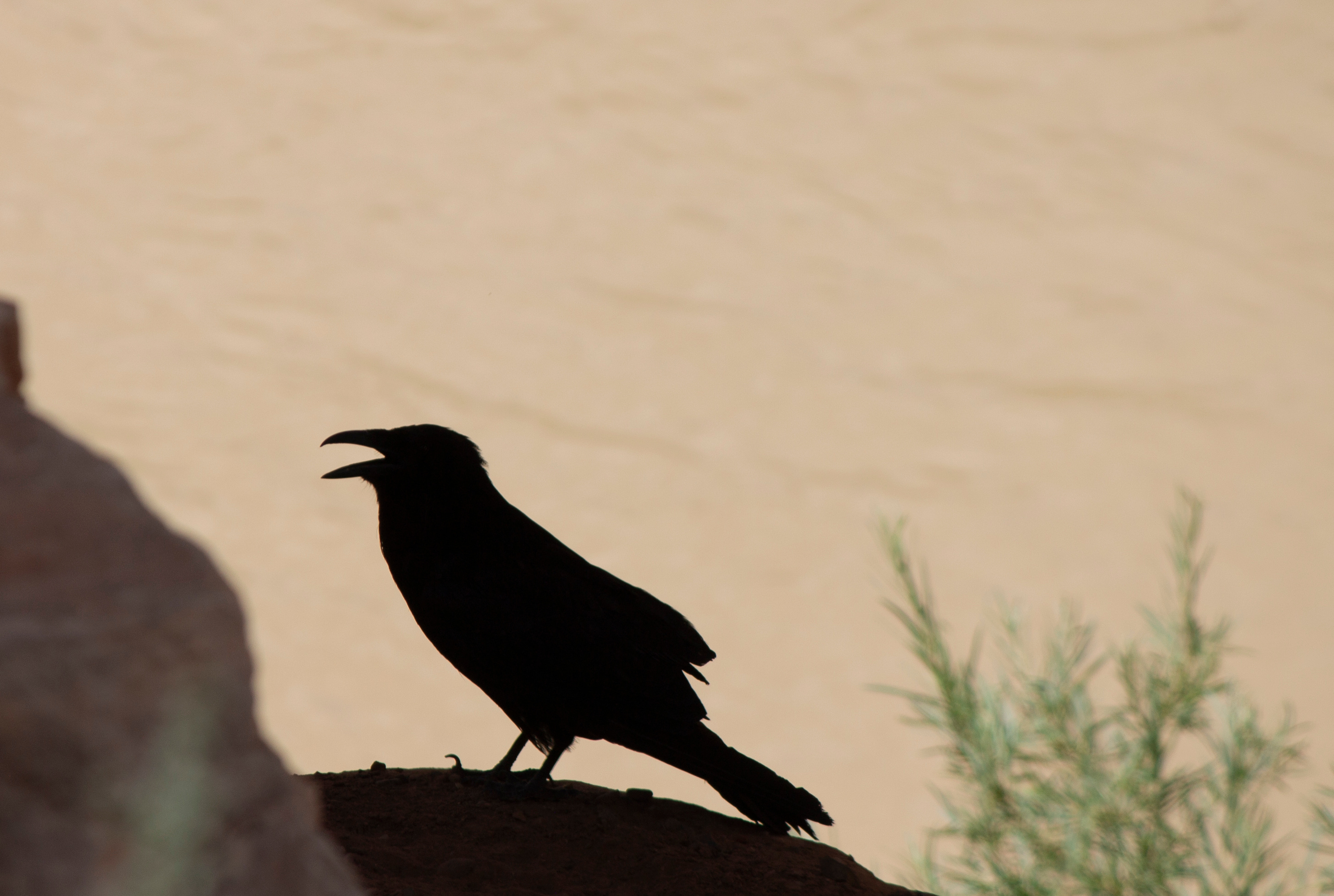
The water was calm and slow, the winds nonexistent. Finally, I could rest my weary shoulders, lay back, look up at rock and sky and listen to the water lapping against the boat and geese honking in the distance. I thought about an old roadmap, from the forties or maybe early fifties, that I was looking at as part of some research on the area. At first glance it looked like a page out of a current road atlas. But as I looked closer I saw subtle, and not so subtle, differences: Highway 95 from Blanding to Natural Bridges National Monument followed a much different route than it does today, and it was gravel. The road to Halls Crossing Marina didn’t show up at all, because the marina, and Lake Powell, for that matter, didn’t yet exist. The stretch of highway from Bluff to Mexican Hat, traversed now in less than a half hour, was labeled in red: “CARRY WATER.” Most heartrending for me, however, was a little piece of text that appeared far from any road, right along the squiggly line representing the lower San Juan River. It was just ten words long, yet read like a poignant eulogy to something that is no longer possible: 191 MILE SCENIC BOAT TRIP MEXICAN HAT TO LEES FERRY. Oh, the things we have lost, I thought, as I watched a raven ride a thermal inches away from a sandstone cliff, hundreds of feet above. Oh the things we have lost.
Norman Norvelle - In 1962 my Boy Scout troop made the trip from Farmington to Mexican Hat. We went the first or second week of June. We took giant used rubber inner tubes from tractor scrapers at Navajo Dam and cut out plywood center that we had on top and bottom of the donut hole and used long all tread bolts to keep the cutout centers in place. The tubes were 8 to 10 feet across (wide). The trip took two weeks. This was before sun block cream was invented. We had 3 boys on the giant inner tubes and 4 inter tubes. When we got to Shiprock 3 or 4 boys quit and went home. The best part of the trip was the last 4 days of the trip. It was amazing and I loved the goose necks. In 1962 the area was still sort of primitive and there weren't many people. We did not see anyone else in canoes or boats. Also, not others on inner tubes. Fishing was terrible.
WOW Jonathan ! What a great trip. I’m looking forward to paddling the San Juan this fall. What’s it like between Navajo Dam & Farmington ?